Air Ambulance Aircraft to Aberdeen City, Pitmedden Road
Saturday, 7 February 2026 | 1:28 | From North Atlantic Ocean
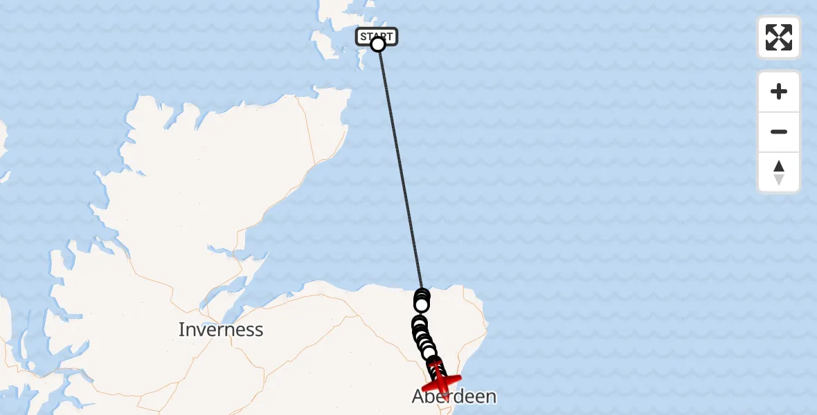
On Saturday, 7 February 2026 at 1:28, a Air Ambulance Aircraft departed from North Atlantic Ocean to Aberdeen City. It was the Air Ambulance Aircraft with registration number G-SASD. The flight lasted 30 minutes. During that period, the aircraft travelled 119 miles at an average speed of 237 miles per hour at a maximum altitude of 15000 feet.
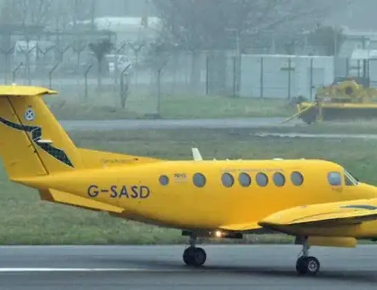
Helicopter: G-SASD
The aircraft G-SASD is used as an air ambulance aircraft. The main purpose of this aircraft is to transport a Mobile Medical Team to an incident as quickly as possible, enabling the trauma doctor to provide immediate first aid on site. The aircraft is flying this flight as Air Ambulance Aircraft.
Photo: Albert Bridge
119 miles
15000 feet
237 mph
31 minutes
01:28
01:59

Route
Pitmedden Road, 01:59
Aberdeen City01:58
Cothal01:58
Newmachar01:57
Keithhall01:57
Old Kendal01:56
Keithhall01:56
Kirkton of Bourtie01:56
Oldmeldrum01:55
St Katherines01:54
Barthol Chapel01:54
St Katherines01:53
Fyvie01:53
Tifty01:53
Steinmanhill01:52
Birkenhills01:52
Turriff01:52
Fintry01:50
Crudie01:50
Longmanhill01:50
Cushnie01:49
North Sea01:29
North Atlantic Ocean, 01:28
Live flights
Today
Helicopter flights on your website?
You can easily display helicopter flights on your own website. Use the embed code.
