Police Helicopter to Tandridge, Moats Lane
Friday, 6 February 2026 | 19:56 | From Salfords
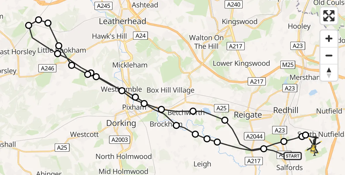
On Friday, 6 February 2026 at 19:56, a Police Helicopter departed from Salfords to Tandridge. It was the Police Helicopter with registration number G-POLH. The flight lasted 14 minutes. During that period, the aircraft travelled 28 miles at an average speed of 119 miles per hour at a maximum altitude of 1900 feet.
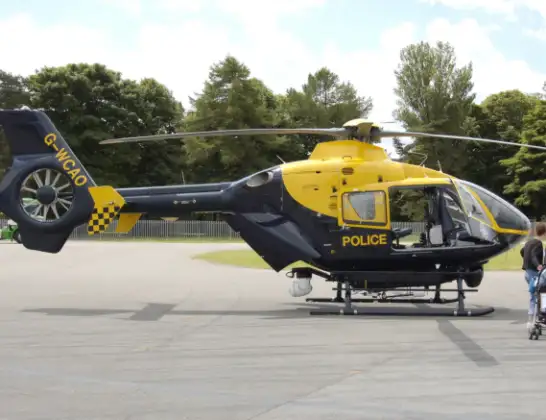
Helicopter: G-POLH
The helicopter G-POLH is used by the British police. The helicopter is deployed in pursuits, missing persons cases and other incidents where a helicopter provides added value.
Photo: Arpingstone
29 miles
1900 feet
119 mph
15 minutes
19:56
20:10

Route
Moats Lane, 20:10
South Nutfield20:09
South Nutfield, Reigate and Banstead20:09
Redhill, Reigate and Banstead20:09
Reigate, Reigate and Banstead20:07
Buckland, Mole Valley20:06
Brockham, Mole Valley20:06
Pixham, Mole Valley20:05
Westhumble, Mole Valley20:04
Great Bookham, Mole Valley20:04
Goldstone Farm Airstrip20:04
Little Bookham, Mole Valley20:03
Effingham, Guildford20:03
Guildford20:03
East Horsley, Guildford20:02
Effingham, Guildford20:01
Great Bookham, Mole Valley20:01
Westhumble, Mole Valley20:00
Pixham, Mole Valley19:59
Brockham, Mole Valley19:59
Betchworth, Mole Valley19:58
Reigate and Banstead19:58
Leigh, Mole Valley19:58
Reigate, Reigate and Banstead19:57
Green Lane, Reigate and Banstead19:56
Live flights
Today
Police Helicopter to Epping Forest, Green Lane26 Feb 23:43
Flights Tandridge
Police Helicopter to Halstead, Halstead20 Feb 13:43
Police Helicopter to Tandridge, Moats Lane19 Feb 17:46
Police Helicopter to Worthing, Worthing13 Feb 01:06
Police Helicopter to Tandridge, Outwood Lane10 Feb 14:05
Police Helicopter to Tandridge, Wychcroft9 Feb 15:19
Police Helicopter to Tandridge, Moats Lane6 Feb 19:56
Flights Salfords
Police Helicopter to Epping Forest, Mott Street26 Feb 20:04
Police Helicopter to Denham, North Orbital Road23 Feb 10:10
Police Helicopter to Shere, Towerhill Lane22 Feb 15:43
Helicopter flights on your website?
You can easily display helicopter flights on your own website. Use the embed code.
