Air Ambulance Helicopter to Royal Bournemouth Hospital, Royal Bournemouth Hospital
Friday, 6 February 2026 | 18:26 | From The Grove
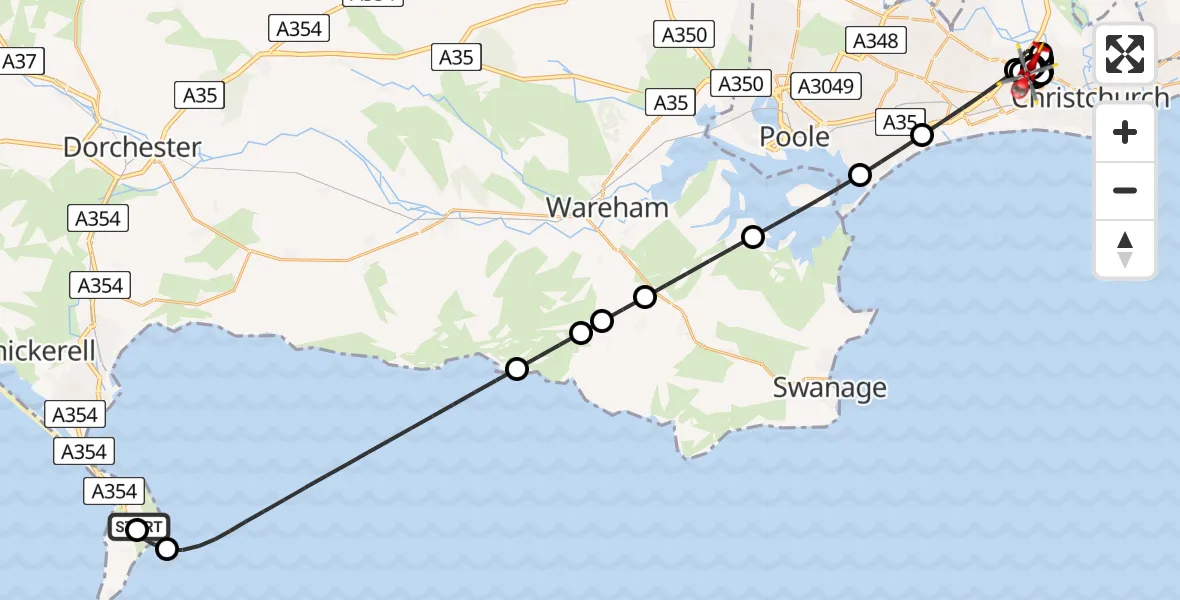
On Friday, 6 February 2026 at 18:26, a Air Ambulance Helicopter departed from The Grove to Royal Bournemouth Hospital. It was the Air Ambulance Helicopter with registration number G-DSAA. The flight lasted 19 minutes. During that period, the aircraft travelled 37 miles at an average speed of 116 miles per hour at a maximum altitude of 2200 feet.
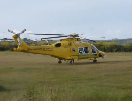
Helicopter: G-DSAA
The helicopter G-DSAA is used as a air ambulance helicopter. The main purpose of this aircraft is to transport a Mobile Medical Team to an incident as quickly as possible, enabling the trauma doctor to provide immediate first aid on site. The aircraft is flying this flight as Air Ambulance Helicopter.
Photo: Andrew Bone
37 miles
2200 feet
116 mph
19 minutes
18:26
18:45

Route
Royal Bournemouth Hospital, Bournemouth18:45
Royal Bournemouth Hospital, Bournemouth18:45
Royal Bournemouth Hospital, Bournemouth18:44
Holdenhurst, Bournemouth18:43
Holdenhurst, Christchurch18:43
Holdenhurst, Bournemouth18:42
Bournemouth18:41
Holdenhurst, Christchurch18:40
Holdenhurst, Bournemouth18:39
Bournemouth18:39
Christchurch18:39
Holdenhurst, Christchurch18:39
Holdenhurst, Bournemouth18:38
Bournemouth18:37
Poole18:36
Studland18:35
Corfe Castle18:34
Furzebrook18:33
Church Knowle18:33
Steeple with Tyneham18:32
English Channel18:28
Bumpers Lane, 18:27
Easton18:27
The Grove18:26
Today
Police Helicopter to Epping Forest, Green Lane26 Feb 23:43
Helicopter flights on your website?
You can easily display helicopter flights on your own website. Use the embed code.
