Air Ambulance Helicopter to Musgrove Hospital
Wednesday, 4 February 2026 | 11:45 | From Taunton
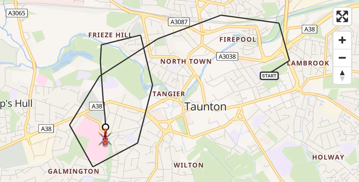
On Wednesday, 4 February 2026 at 11:45, a Air Ambulance Helicopter departed from Taunton to Musgrove Hospital. It was the Air Ambulance Helicopter with registration number G-DSAA. The flight lasted 11 minutes. During that period, the aircraft travelled 5 miles at an average speed of 26 miles per hour at a maximum altitude of 1325 feet.
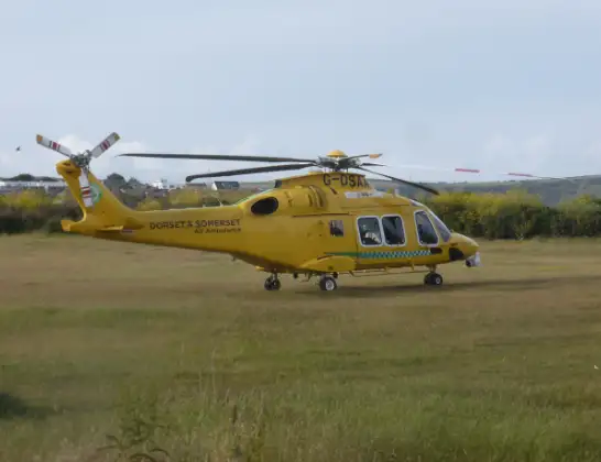
Helicopter: G-DSAA
The helicopter G-DSAA is used as a air ambulance helicopter. The main purpose of this aircraft is to transport a Mobile Medical Team to an incident as quickly as possible, enabling the trauma doctor to provide immediate first aid on site. The aircraft is flying this flight as Air Ambulance Helicopter.
Photo: Andrew Bone
5 miles
1325 feet
26 mph
11 minutes
11:45
11:56

Route
Musgrove Hospital, Taunton11:56
Musgrove Hospital, Taunton11:56
Cranmer Road, 11:51
Taunton11:45
Live flights
Police Helicopter on its way from Dundrod12 Jul 22:50
Today
Police Helicopter to East Ardsley, Stoney Lane12 Jul 23:51
Police Helicopter to Birmingham Airport12 Jul 23:46
Police Helicopter to Parkham Ash12 Jul 23:41
Air Ambulance Helicopter to Newlands of Culloden12 Jul 23:24
Flights Taunton
Air Ambulance Helicopter to Burrington6 Jul 12:50
Air Ambulance Helicopter to Taunton, Trull Road12 Jun 13:20
Air Ambulance Helicopter to Henstridge Airfield25 May 19:04
Police Helicopter to Rockbeare, Silver Lane19 May 19:29
Helicopter flights on your website?
You can easily display helicopter flights on your own website. Use the embed code.
