Police Helicopter to Redhill Aerodrome, Redhill Aerodrome
Wednesday, 4 February 2026 | 10:12 | From Dockenfield
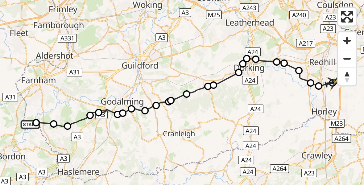
On Wednesday, 4 February 2026 at 10:12, a Police Helicopter departed from Dockenfield to Redhill Aerodrome. It was the Police Helicopter with registration number G-POLH. The flight lasted 19 minutes. During that period, the aircraft travelled 34 miles at an average speed of 105 miles per hour at a maximum altitude of 2700 feet.
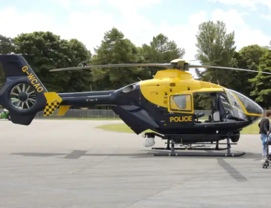
Helicopter: G-POLH
The helicopter G-POLH is used by the British police. The helicopter is deployed in pursuits, missing persons cases and other incidents where a helicopter provides added value.
Photo: Arpingstone
34 miles
2700 feet
105 mph
20 minutes
10:12
10:32

Route
Redhill Aerodrome, Redhill, Surrey10:32
Redhill Aerodrome, Redhill, Surrey10:31
Salfords, Reigate and Banstead10:30
Reigate and Banstead10:29
Reigate, Reigate and Banstead10:28
Buckland, Mole Valley10:27
Betchworth, Mole Valley10:27
Pixham, Mole Valley10:25
Westhumble, Mole Valley10:25
Dorking, Mole Valley10:24
Westcott, Mole Valley10:24
Abinger, Mole Valley10:22
Abinger Hammer, Mole Valley10:22
Shere, Guildford10:21
Guildford10:20
Waverley10:20
Shamley Green, Waverley10:19
Grafham, Waverley10:19
Waverley10:18
Godalming, Waverley10:18
Enton Green, Waverley10:17
Milford, Waverley10:16
Waverley10:16
Thursley, Waverley10:15
Waverley10:14
Frensham, Waverley10:13
Old Lane, Waverley10:12
Today
Police Helicopter to Epping Forest, Green Lane26 Feb 23:43
Flights Dockenfield
Helicopter flights on your website?
You can easily display helicopter flights on your own website. Use the embed code.
