Police Helicopter to MOD St Athan
Monday, 2 February 2026 | 0:22 | From Swansea
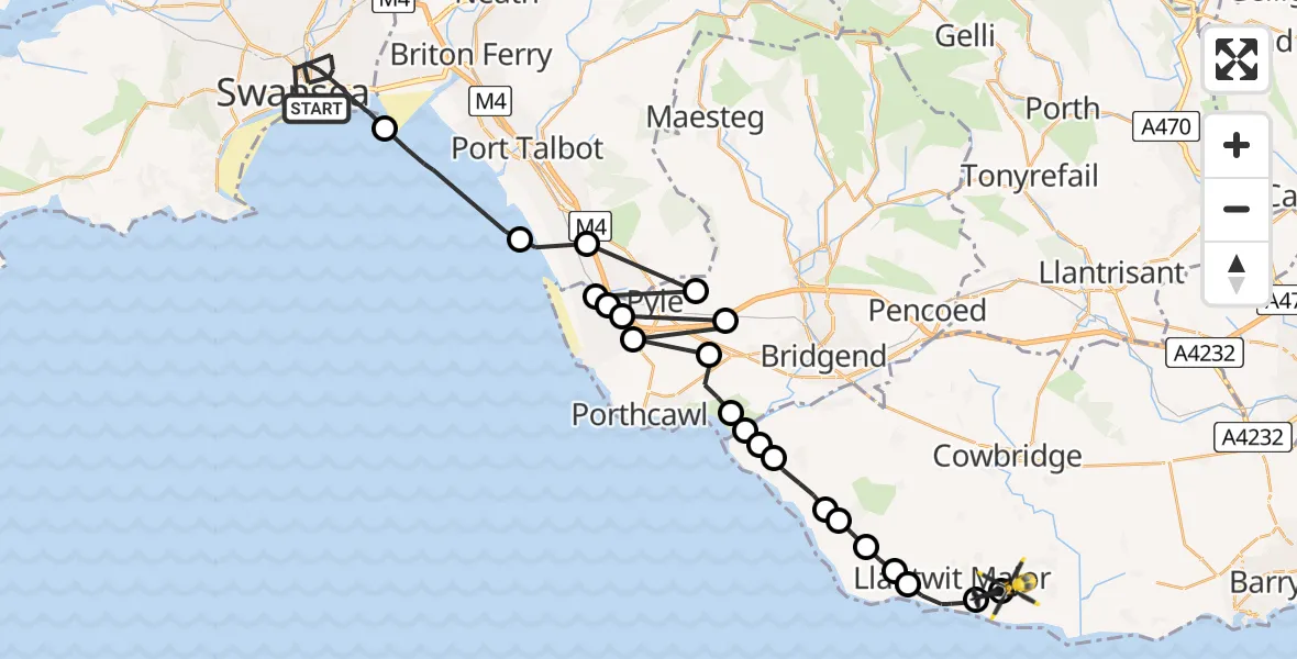
On Monday, 2 February 2026 at 0:22, a Police Helicopter departed from Swansea to MOD St Athan. It was the Police Helicopter with registration number G-NWOI. The flight lasted 17 minutes. During that period, the aircraft travelled 44 miles at an average speed of 153 miles per hour at a maximum altitude of 2050 feet.

Helicopter: G-NWOI
The helicopter G-NWOI is used by the British police. The helicopter is deployed in pursuits, missing persons cases and other incidents where a helicopter provides added value.
Photo: Alec Wilson
44 miles
2050 feet
153 mph
18 minutes
00:22
00:39

Route
MOD St Athan, St Athan, Vale of Glamorgan00:39
MOD St Athan, St Athan, Vale of Glamorgan00:39
Boverton00:38
Llantwit Major00:37
St Donats00:37
Marcross00:36
Broughton00:36
Monknash00:35
St Brides Major00:34
Southerndown00:34
Ogmore-by-Sea00:34
Merthyr Mawr00:34
Tythegston00:33
Mawdlam00:32
Cefn Cribwr00:32
Mawdlam00:32
Kenfig00:31
Cornelly00:31
Kenfig Hill00:31
Eglwys Nunydd Reservoir00:31
Port Talbot00:30
Bristol Channel00:27
Trawler Road, 00:22
Today
Flights Swansea
Helicopter flights on your website?
You can easily display helicopter flights on your own website. Use the embed code.
