Police Helicopter to MOD St Athan
Sunday, 1 February 2026 | 21:39 | From Flemingston
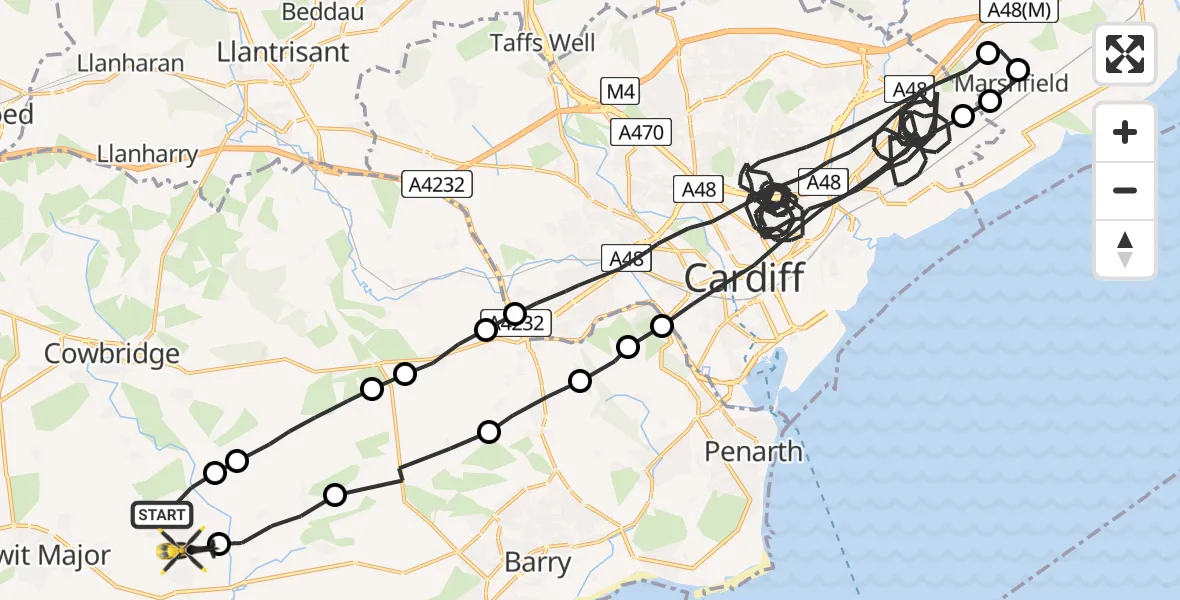
On Sunday, 1 February 2026 at 21:39, a Police Helicopter departed from Flemingston to MOD St Athan. It was the Police Helicopter with registration number G-NWOI. The flight lasted 51 minutes. During that period, the aircraft travelled 74 miles at an average speed of 88 miles per hour at a maximum altitude of 1975 feet.

Helicopter: G-NWOI
The helicopter G-NWOI is used by the British police. The helicopter is deployed in pursuits, missing persons cases and other incidents where a helicopter provides added value.
Photo: James from Cheltenham
74 miles
1975 feet
88 mph
51 minutes
21:39
22:30

Route
MOD St Athan, St Athan, Vale of Glamorgan22:30
St Athan22:29
Llancarfan22:28
Dyffryn22:27
Wenvoe22:26
Michaelston-le-Pit22:26
Michaelston-le-Pit and Leckwith22:26
Cardiff22:23
Newport22:23
Marshfield, Newport22:22
Castleton, Newport22:22
Cardiff21:42
Drope21:42
St Nicholas21:41
St Nicholas and Bonvilston21:41
Llancarfan21:40
Llanfair21:39
Flemingston, 21:39
Today
Flights Flemingston
Police Helicopter to Flemingston, Burley Place31 May 18:04
Police Helicopter to MOD St Athan22 May 02:25
Police Helicopter to Flemingston, Mallory Close19 May 11:45
Police Helicopter to Flemingston, Mallory Close17 May 19:53
Police Helicopter to Flemingston, Burley Place13 May 02:20
Police Helicopter to Flemingston, Mallory Close12 May 12:53
Police Helicopter to Boverton, B426510 May 21:53
Police Helicopter to St Athan, Rock Road7 May 01:22
Police Helicopter to MOD St Athan5 May 13:33
Helicopter flights on your website?
You can easily display helicopter flights on your own website. Use the embed code.
