Police Helicopter to Salfords, Kings Mill Lane
Saturday, 31 January 2026 | 21:02 | From Guildford
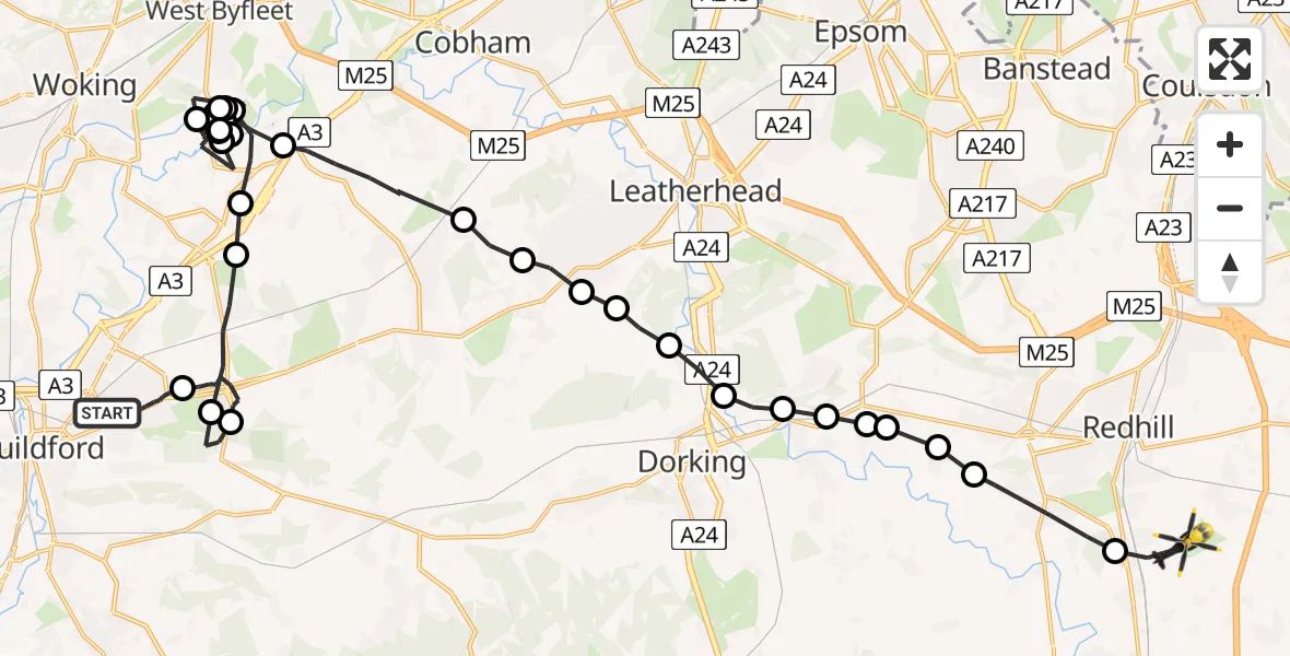
On Saturday, 31 January 2026 at 21:02, a Police Helicopter departed from Guildford to Salfords. It was the Police Helicopter with registration number G-POLH. The flight lasted 29 minutes. During that period, the aircraft travelled 37 miles at an average speed of 77 miles per hour at a maximum altitude of 1700 feet.
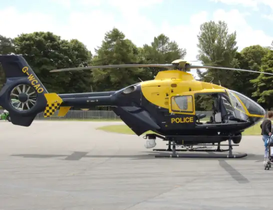
Helicopter: G-POLH
The helicopter G-POLH is used by the British police. The helicopter is deployed in pursuits, missing persons cases and other incidents where a helicopter provides added value.
Photo: Arpingstone
38 miles
1700 feet
77 mph
30 minutes
21:02
21:31

Route
Kings Mill Lane, Reigate and Banstead21:31
Salfords, Reigate and Banstead21:31
Reigate, Reigate and Banstead21:29
Buckland, Reigate21:29
Buckland, Mole Valley21:29
Betchworth, Mole Valley21:29
Box Hill Village, Mole Valley21:28
Brockham, Mole Valley21:28
Pixham, Mole Valley21:28
Westhumble, Mole Valley21:27
Hawk's Hill, Mole Valley21:27
Great Bookham, Mole Valley21:26
Little Bookham, Mole Valley21:26
Effingham, Guildford21:25
Ockham, Guildford21:24
Pyrford, Woking21:18
Ripley, Guildford21:17
Pyrford, Woking21:16
Ripley, Guildford21:16
Pyrford, Woking21:15
Ripley, Guildford21:14
Pyrford, Woking21:13
Ripley, Guildford21:12
Pyrford, Woking21:12
Ripley, Guildford21:11
Pyrford, Woking21:10
Ripley, Guildford21:09
Guildford21:09
West Clandon, Guildford21:08
Guildford21:07
West Clandon, Guildford21:05
Boxgrove Road, 21:02
Live flights
Today
Flights Salfords
Police Helicopter to Mytchett, Lynchford Lane28 May 15:39
Police Helicopter to Redhill Aerodrome25 May 01:13
Police Helicopter to Salfords, Axes Lane23 May 22:43
Police Helicopter to Salfords, Lake Lane23 May 20:16
Police Helicopter to North Weald Airfield23 May 20:04
Police Helicopter to Tandridge, Crab Hill Lane23 May 00:50
Police Helicopter to Tandridge, Crab Hill Lane22 May 23:20
Police Helicopter to Guildford, Epsom Road22 May 12:21
Flights Guildford
Police Helicopter to Redhill Aerodrome25 May 17:30
Air Ambulance Helicopter to St Georges Hospital23 May 18:28
Police Helicopter to Guildford, Epsom Road22 May 12:21
Air Ambulance Helicopter to St Georges Hospital17 May 17:10
Air Ambulance Helicopter to Redhill Aerodrome16 May 10:36
Helicopter flights on your website?
You can easily display helicopter flights on your own website. Use the embed code.
