Air Ambulance Helicopter to Stanton St Quintin, A429
Saturday, 31 January 2026 | 17:01 | From Wiltshire Air Ambulance
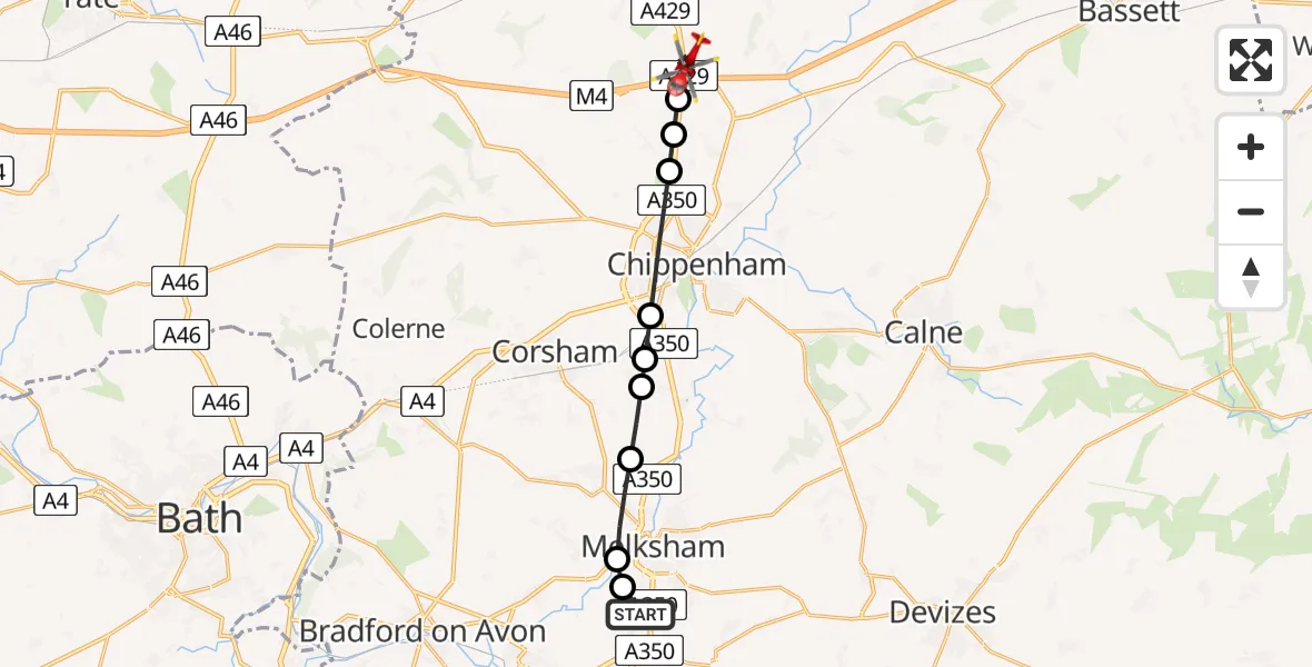
On Saturday, 31 January 2026 at 17:01, a Air Ambulance Helicopter departed from Wiltshire Air Ambulance to Stanton St Quintin. It was the Air Ambulance Helicopter with registration number G-WLTS. The flight lasted 6 minutes. During that period, the aircraft travelled 13 miles at an average speed of 124 miles per hour at a maximum altitude of 1300 feet.
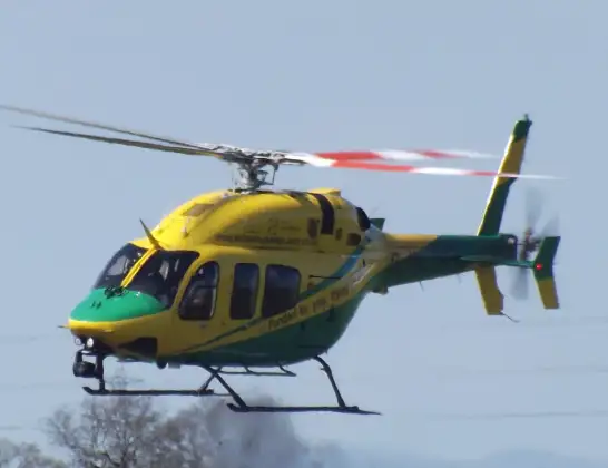
Helicopter: G-WLTS
The helicopter G-WLTS is used as a air ambulance helicopter. The main purpose of this aircraft is to transport a Mobile Medical Team to an incident as quickly as possible, enabling the trauma doctor to provide immediate first aid on site. The aircraft is flying this flight as Air Ambulance Helicopter.
Photo: James
14 miles
1300 feet
124 mph
7 minutes
17:01
17:07

Route
A429, 17:07
A429, 17:07
Stanton St Quintin17:04
Kington Langley17:04
Kington St Michael17:04
Chippenham17:03
Lacock17:03
Corsham17:02
Beanacre17:02
Melksham17:01
Berryfield17:01
High Street, 17:01
Live flights
Police Helicopter on its way from RAF Benson12 Jul 22:54
Police Helicopter on its way from Dundrod12 Jul 22:50
Police Helicopter on its way from East Ardsley12 Jul 22:44
Police Helicopter on its way from Worsley12 Jul 22:11
Today
Air Ambulance Helicopter to Norwich Airport12 Jul 22:27
Air Ambulance Helicopter to Northrepps Aerodrome12 Jul 22:23
Police Helicopter to Harborough, Sulby Road12 Jul 22:20
Air Ambulance Helicopter to Derriford Hospital12 Jul 22:12
Air Ambulance Helicopter to Northrepps Aerodrome12 Jul 22:03
Air Ambulance Helicopter to Warwick, Henley Road12 Jul 21:38
Helicopter flights on your website?
You can easily display helicopter flights on your own website. Use the embed code.
