Air Ambulance Helicopter to City of Nottingham, University Boulevard
Saturday, 31 January 2026 | 13:18 | From Widmerpool
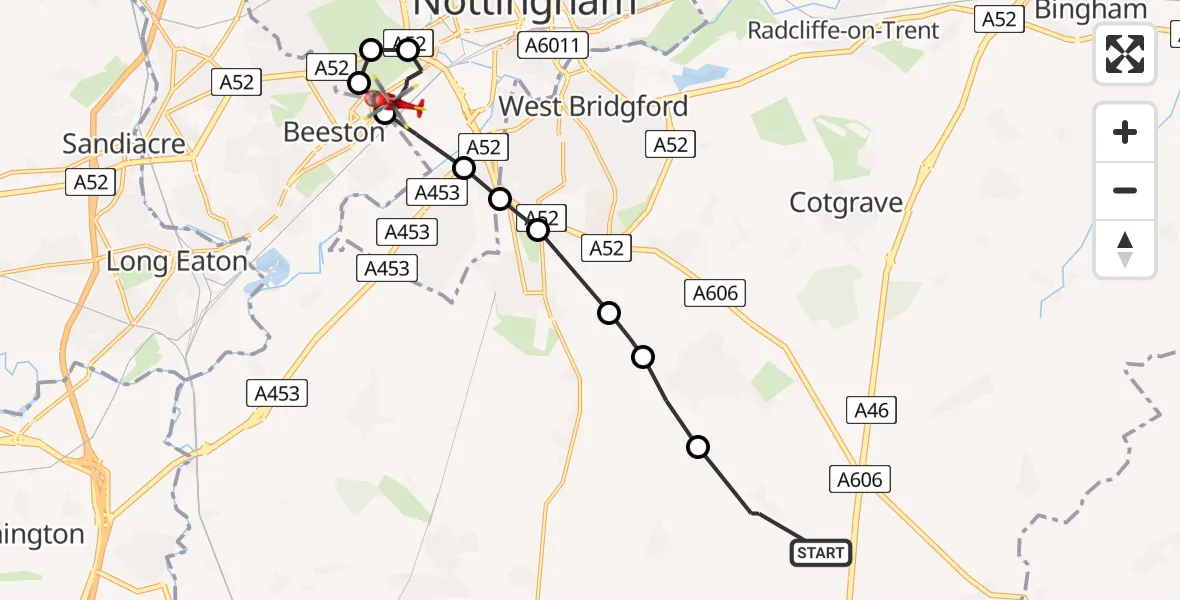
On Saturday, 31 January 2026 at 13:18, a Air Ambulance Helicopter departed from Widmerpool to City of Nottingham. It was the Air Ambulance Helicopter with registration number G-DRLA. The flight lasted 5 minutes. During that period, the aircraft travelled 12 miles at an average speed of 138 miles per hour at a maximum altitude of 1575 feet.
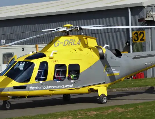
Helicopter: G-DRLA
The helicopter G-DRLA is used as an ambulance helicopter. The helicopter is equipped with a stretcher for transporting patients. The helicopter is often used to transport to hospitals.
Photo: Alec Wilson
12 miles
1575 feet
138 mph
6 minutes
13:18
13:23

Route
University Boulevard, East Midlands13:23
City of Nottingham, East Midlands13:22
Wollaton, City of Nottingham13:22
City of Nottingham, East Midlands13:21
Beeston, City of Nottingham13:21
City of Nottingham, East Midlands13:21
Ruddington, West Bridgford13:20
West Bridgford, Rushcliffe13:20
Ruddington, Rushcliffe13:20
Bradmore, Rushcliffe13:19
Keyworth, Rushcliffe13:19
Penn Lane, Rushcliffe13:18
Live flights
Today
Police Helicopter to Connah's Quay28 May 23:33
Air Ambulance Helicopter to Nottingham Heliport28 May 23:32
Air Ambulance Aircraft to Glasgow Airport28 May 23:31
Air Ambulance Helicopter to Redhill Aerodrome28 May 23:29
Air Ambulance Helicopter to Southampton Airport28 May 23:28
Police Helicopter to North Weald Airfield28 May 22:46
Flights Widmerpool
Air Ambulance Helicopter to Buxton, Green Lane27 May 16:32
Air Ambulance Helicopter to Nottingham Heliport26 May 06:46
Air Ambulance Helicopter to Nottingham Heliport24 May 20:33
Air Ambulance Helicopter to Nottingham Heliport24 May 18:50
Helicopter flights on your website?
You can easily display helicopter flights on your own website. Use the embed code.
