Coastguard Helicopter to St. John's Castlerigg and Wythburn
Friday, 30 January 2026 | 17:13 | From Caernarfon Airport
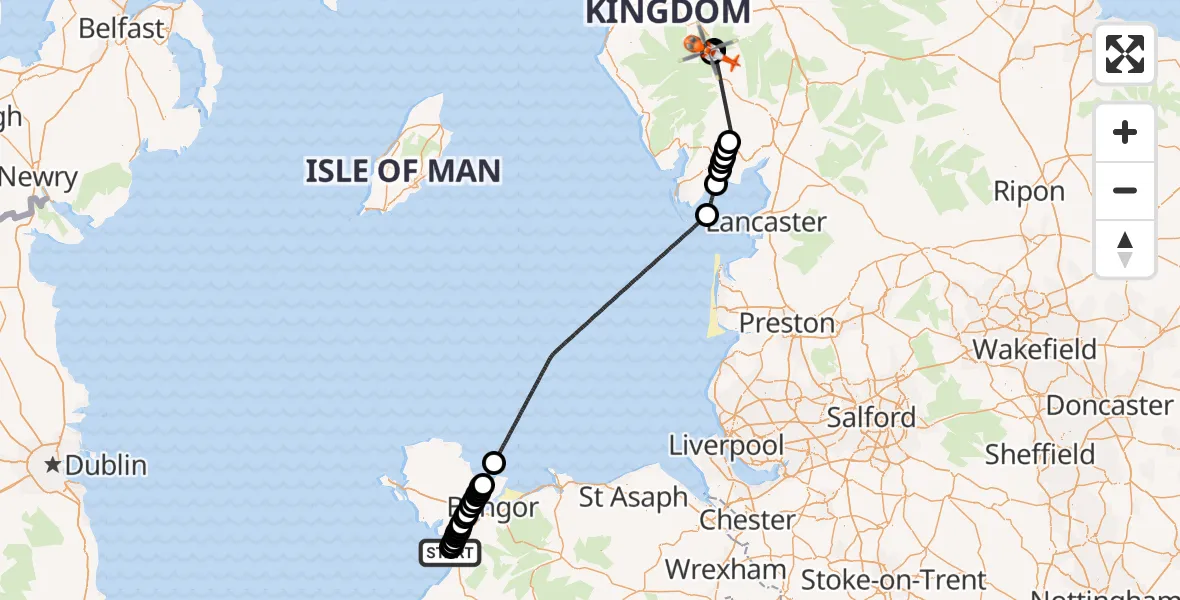
On Friday, 30 January 2026 at 17:13, a Coastguard Helicopter departed from Caernarfon Airport to St. John's Castlerigg and Wythburn. It was the Coastguard Helicopter with registration number G-MCGY. The flight lasted 73 minutes. During that period, the aircraft travelled 120 miles at an average speed of 99 miles per hour at a maximum altitude of 2650 feet.
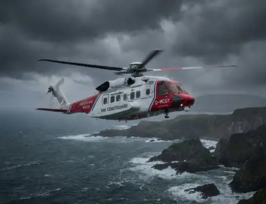
Helicopter: G-MCGY
The helicopter G-MCGY is used by the British Coastguard. The helicopter is deployed in search and rescue operations at sea, rescue operations involving ships or drilling platforms, patrols to prevent smuggling or piracy, environmental monitoring and disaster relief support.
120 miles
2650 feet
99 mph
73 minutes
17:13
18:26

Route
St. John's Castlerigg and Wythburn, 18:26
St. John's Castlerigg and Wythburn18:26
Thirlmere18:14
St. John's Castlerigg and Wythburn18:14
Finsthwaite18:03
Backbarrow18:03
Low Wood18:02
Lower Allithwaite18:01
Low Wood18:01
Lower Allithwaite17:59
Aldingham17:57
Irish Sea17:29
Llanddona17:27
Pentraeth17:27
Cwm Cadnant17:27
Pentraeth17:27
Penmynydd and Star17:26
Penmynydd17:26
Star17:25
Llanddaniel Fab17:25
Llanfairpwllgwyngyll17:24
Brynsiencyn17:24
Dwyran17:23
Rhosyr17:23
Bontnewydd17:23
Dwyran17:23
Bontnewydd17:22
Llandwrog17:22
Llanfaglan17:21
Caernarfon Airport, Caernarfon17:21
Caernarfon Airport, Caernarfon17:13
Live flights
Today
Helicopter flights on your website?
You can easily display helicopter flights on your own website. Use the embed code.
