Air Ambulance Helicopter to Longnewton, Longnewton
Friday, 30 January 2026 | 16:09 | From West Cornforth
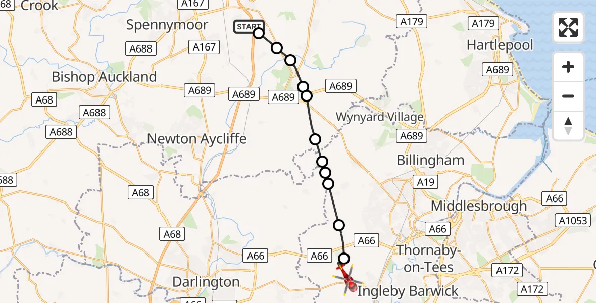
On Friday, 30 January 2026 at 16:09, a Air Ambulance Helicopter departed from West Cornforth to Longnewton. It was the Air Ambulance Helicopter with registration number G-NHAE. The flight lasted 7 minutes. During that period, the aircraft travelled 14 miles at an average speed of 114 miles per hour at a maximum altitude of 1925 feet.
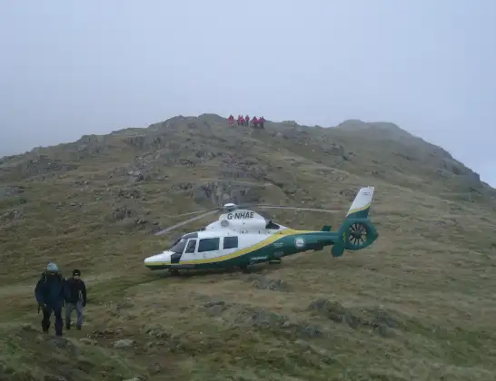
Helicopter: G-NHAE
The helicopter G-NHAE is used as a air ambulance helicopter. The main purpose of this aircraft is to transport a Mobile Medical Team to an incident as quickly as possible, enabling the trauma doctor to provide immediate first aid on site. The aircraft is flying this flight as Air Ambulance Helicopter.
Photo: Michael Earnshaw
14 miles
1925 feet
114 mph
8 minutes
16:09
16:16

Route
Longnewton, Tees Valley16:16
Longnewton, Tees Valley16:15
Elton, Tees Valley16:14
Redmarshall, Tees Valley16:13
Stillington and Whitton, Tees Valley16:13
Stillington, Tees Valley16:13
Stockton-on-Tees, North East16:12
Sedgefield, North East16:11
Stockton-on-Tees, North East16:11
Sedgefield, North East16:10
Fishburn, North East16:10
Bishop Middleham, North East16:09
Stobb Cross Lane, North East16:09
Today
Police Helicopter to Epping Forest, Green Lane26 Feb 23:43
Flights Longnewton
Police Helicopter to Longnewton, A6729 Jan 08:05
Air Ambulance Helicopter to Elton, Coatham Lane24 Jan 17:13
Helicopter flights on your website?
You can easily display helicopter flights on your own website. Use the embed code.
