Air Ambulance Helicopter to Tinsley Green, James Watt Way
Friday, 30 January 2026 | 15:42 | From Redhill Aerodrome
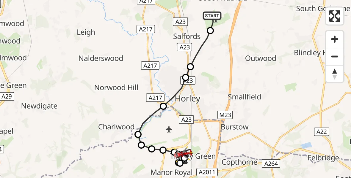
On Friday, 30 January 2026 at 15:42, a Air Ambulance Helicopter departed from Redhill Aerodrome to Tinsley Green. It was the Air Ambulance Helicopter with registration number G-KSSC. The flight lasted 11 minutes. During that period, the aircraft travelled 11 miles at an average speed of 61 miles per hour at a maximum altitude of 1875 feet.
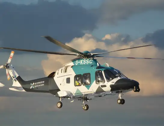
Helicopter: G-KSSC
The helicopter G-KSSC is used as a air ambulance helicopter. The main purpose of this aircraft is to transport a Mobile Medical Team to an incident as quickly as possible, enabling the trauma doctor to provide immediate first aid on site. The aircraft is flying this flight as Air Ambulance Helicopter.
Photo: Shona aakss
11 miles
1875 feet
61 mph
11 minutes
15:42
15:53

Route
James Watt Way, Crawley15:53
Tinsley Green, Crawley15:50
Manor Royal, Crawley15:50
Tinsley Green, Crawley15:50
Manor Royal, Crawley15:49
Tinsley Green, Crawley15:49
Manor Royal, Crawley15:48
Langley Green, Crawley15:48
London Gatwick Airport, London15:48
Charlwood, Mole Valley15:48
Hookwood, Mole Valley15:47
Horley, Reigate and Banstead15:46
Reigate and Banstead15:46
Salfords, Reigate and Banstead15:45
Redhill Aerodrome, Redhill, Surrey15:44
Redhill Aerodrome, Redhill, Surrey15:42
Live flights
Today
Police Helicopter to Epping Forest, Green Lane26 Feb 23:43
Helicopter flights on your website?
You can easily display helicopter flights on your own website. Use the embed code.
