Air Ambulance Helicopter to Henstridge, Henstridge Airfield
Friday, 30 January 2026 | 8:39 | From Wareham
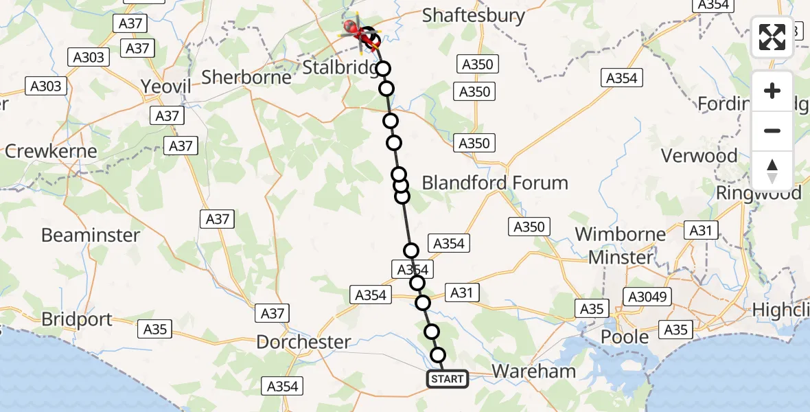
On Friday, 30 January 2026 at 8:39, a Air Ambulance Helicopter departed from Wareham to Henstridge. It was the Air Ambulance Helicopter with registration number G-DSAA. The flight lasted 10 minutes. During that period, the aircraft travelled 22 miles at an average speed of 137 miles per hour at a maximum altitude of 2250 feet.
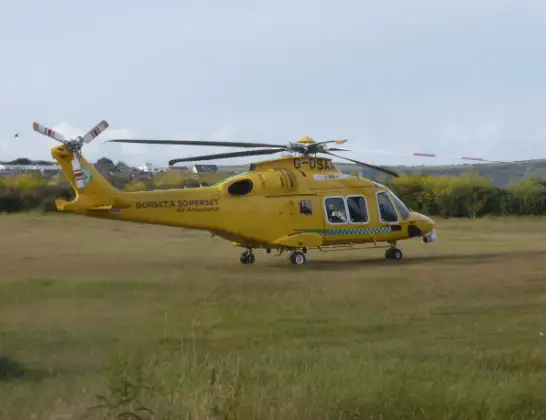
Helicopter: G-DSAA
The helicopter G-DSAA is used as a air ambulance helicopter. The main purpose of this aircraft is to transport a Mobile Medical Team to an incident as quickly as possible, enabling the trauma doctor to provide immediate first aid on site. The aircraft is flying this flight as Air Ambulance Helicopter.
Photo: Andrew Bone
23 miles
2250 feet
137 mph
10 minutes
08:39
08:49

Route
Henstridge Airfield, 08:49
Henstridge08:49
Fifehead Magdalen08:49
Stalbridge08:48
Marnhull08:48
Hinton St Mary08:47
Sturminster Newton08:46
Fifehead St Quintin08:46
Ibberton08:45
Winterborne Houghton08:45
Woolland08:45
Milton Abbas08:43
Milborne St Andrew08:43
Tolpuddle08:42
Affpuddle and Turnerspuddle08:41
Bovington08:41
Water Meadow Lane, 08:40
Wareham08:39
Live flights
Today
Police Helicopter to Epping Forest, Green Lane26 Feb 23:43
Flights Henstridge
Flights Wareham
Helicopter flights on your website?
You can easily display helicopter flights on your own website. Use the embed code.
