Police Helicopter to Newcastle upon Tyne, Eagle Close
Thursday, 29 January 2026 | 20:20 | From Newcastle upon Tyne
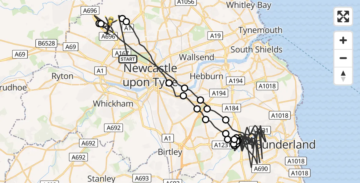
On Thursday, 29 January 2026 at 20:20, a Police Helicopter departed from Newcastle upon Tyne to Newcastle upon Tyne. It was the Police Helicopter with registration number G-POLA. The flight lasted 43 minutes. During that period, the aircraft travelled 76 miles at an average speed of 106 miles per hour at a maximum altitude of 1700 feet.
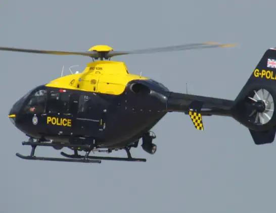
Helicopter: G-POLA
The helicopter G-POLA is used by the British police. The helicopter is deployed in pursuits, missing persons cases and other incidents where a helicopter provides added value.
Photo: ozz13x
76 miles
1700 feet
106 mph
43 minutes
20:20
21:03

Route
Eagle Close, North East21:03
Newcastle upon Tyne, North East21:03
Callerton, Newcastle upon Tyne21:02
Newcastle upon Tyne, North East20:58
Pelaw, Gateshead20:57
Gateshead, North East20:57
South Tyneside, North East20:56
Sunderland, North East20:49
Washington, Sunderland20:48
Sunderland, North East20:46
Washington, Sunderland20:46
Sunderland, North East20:44
Washington, Sunderland20:44
Sunderland, North East20:28
Washington, Sunderland20:28
Sunderland, North East20:28
Washington, Sunderland20:27
Gateshead, North East20:26
Pelaw, Gateshead20:25
Gateshead, North East20:24
Newcastle upon Tyne, North East20:21
Hazlerigg Village, Newcastle upon Tyne20:21
Ponteland Road, North East20:20
Live flights
Today
Police Helicopter to Ilfracombe13:52:31
Helicopter flights on your website?
You can easily display helicopter flights on your own website. Use the embed code.
