Coastguard Helicopter to North Atlantic Ocean, North Atlantic Ocean
Thursday, 29 January 2026 | 18:40 | From Cornwall Airport Newquay
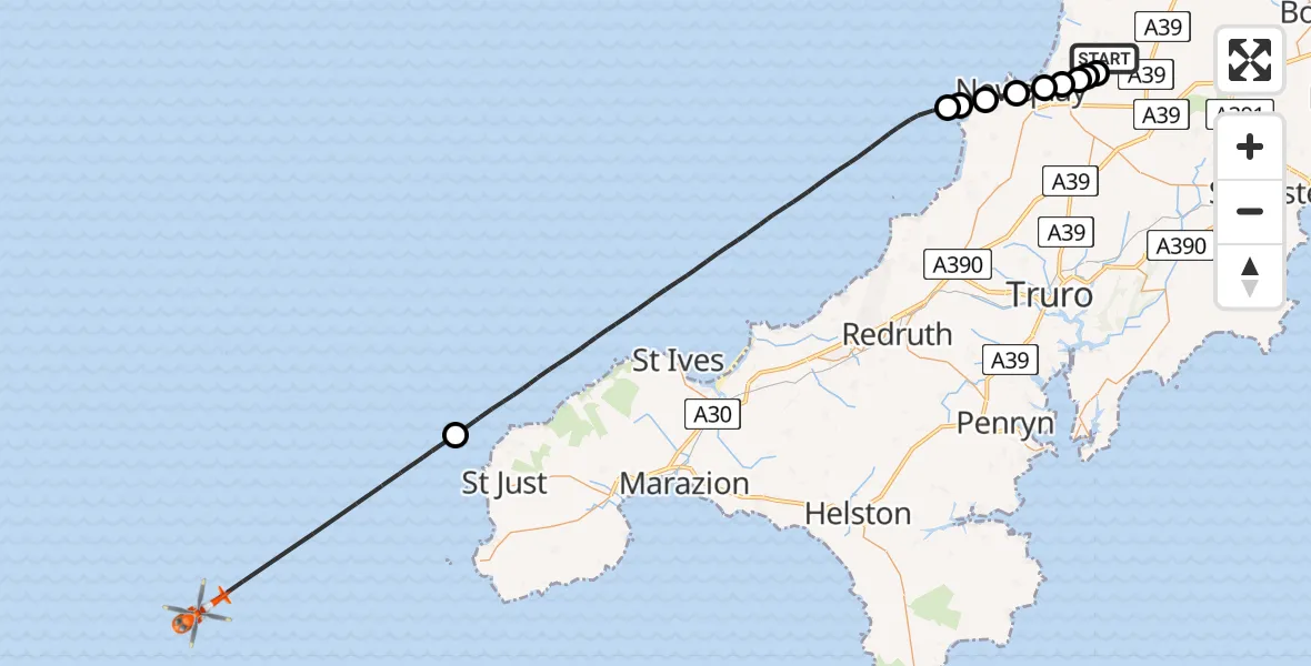
On Thursday, 29 January 2026 at 18:40, a Coastguard Helicopter departed from Cornwall Airport Newquay to North Atlantic Ocean. It was the Coastguard Helicopter with registration number G-MCGJ. The flight lasted 23 minutes. During that period, the aircraft travelled 55 miles at an average speed of 143 miles per hour at a maximum altitude of 1600 feet.
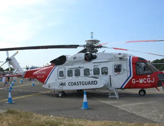
Helicopter: G-MCGJ
The helicopter G-MCGJ is used by the British Coastguard. The helicopter is deployed in search and rescue operations at sea, rescue operations involving ships or drilling platforms, patrols to prevent smuggling or piracy, environmental monitoring and disaster relief support.
Photo: simon butler
56 miles
1600 feet
143 mph
24 minutes
18:40
19:03

Route
North Atlantic Ocean, 19:03
North Atlantic Ocean18:56
Bristol Channel18:44
Holywell18:44
Crantock18:43
Newquay18:42
Porth, Newquay18:42
A3058, Newquay18:42
St. Columb Minor, Newquay18:41
St. Columb Minor, 18:41
St. Columb Minor18:41
Trebarva18:41
A3059, 18:40
Cornwall Airport Newquay, Newquay18:40
Live flights
Today
Police Helicopter to Epping Forest, Green Lane26 Feb 23:43
Helicopter flights on your website?
You can easily display helicopter flights on your own website. Use the embed code.
