Air Ambulance Helicopter to Shobdon Airfield, Pembridge
Thursday, 29 January 2026 | 17:47 | From Hill Croome
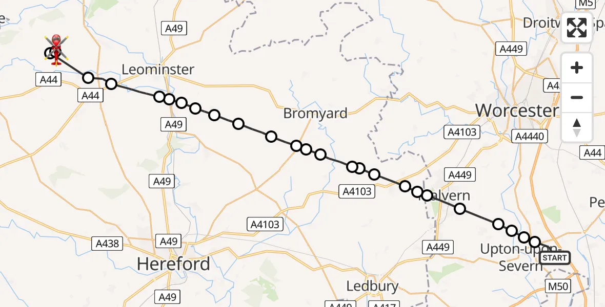
On Thursday, 29 January 2026 at 17:47, a Air Ambulance Helicopter departed from Hill Croome to Shobdon Airfield. It was the Air Ambulance Helicopter with registration number G-OMAA. The flight lasted 14 minutes. During that period, the aircraft travelled 34 miles at an average speed of 144 miles per hour at a maximum altitude of 2525 feet.
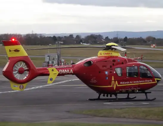
Helicopter: G-OMAA
The helicopter G-OMAA is used as a air ambulance helicopter. The main purpose of this aircraft is to transport a Mobile Medical Team to an incident as quickly as possible, enabling the trauma doctor to provide immediate first aid on site. The aircraft is flying this flight as Air Ambulance Helicopter.
Photo: James from Cheltenham, Gloucestershire
34 miles
2525 feet
144 mph
15 minutes
17:47
18:02

Route
Shobdon Airfield, Leominster, Herefordshire18:02
Shobdon Airfield, Leominster, Herefordshire18:00
Pembridge, 18:00
Eardisland17:58
Monkland17:58
Ivington, Leominster17:57
Leominster17:56
Ford and Stoke Prior17:56
Stoke Prior17:56
Risbury17:55
Pencombe with Grendon Warren17:55
Pencombe17:54
Stoke Lacy17:54
Stoke Lane17:53
Bromyard17:53
Bishop's Frome17:52
Evesbatch17:52
Stony Cross17:52
Cradley17:51
Mathon17:51
West Malvern, Malvern17:51
Malvern, Malvern Hills17:50
Hanley Castle, Malvern Hills17:49
Hanley Castle, Upton-upon-Severn17:49
Ripple, Worcester17:48
Earl's Croome, Malvern Hills17:48
Strensham Road, Malvern Hills17:47
Live flights
Today
Helicopter flights on your website?
You can easily display helicopter flights on your own website. Use the embed code.
