Police Helicopter to Epping Forest, Mott Street
Thursday, 29 January 2026 | 16:56 | From Sewardstonebury
On Thursday, 29 January 2026 at 16:56, a Police Helicopter departed from Sewardstonebury to Epping Forest. It was the Police Helicopter with registration number G-MPSC. The flight lasted 15 minutes. During that period, the aircraft travelled 31 miles at an average speed of 125 miles per hour at a maximum altitude of 1625 feet.
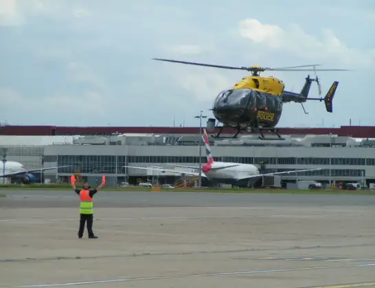
Helicopter: G-MPSC
The helicopter G-MPSC is used by the British police. The helicopter is deployed in pursuits, missing persons cases and other incidents where a helicopter provides added value.
Photo: Simon Boddy
32 miles
1625 feet
125 mph
16 minutes
16:56
17:12

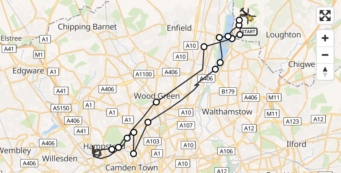
Route
Mott Street, Essex17:12
Epping Forest, Essex17:11
Sewardstonebury, Epping Forest17:11
King George V Reservoir17:10
London Borough of Enfield, Greater London17:10
William Girling Reservoir17:09
London Borough of Enfield, Greater London17:09
London Borough of Haringey, Greater London17:07
London Borough of Camden, Greater London17:07
London Borough of Islington, Greater London17:06
London Borough of Camden, Greater London17:06
Royal Free Hospital, London17:06
London Borough of Camden, Greater London17:00
London Borough of Haringey, Greater London16:59
London Borough of Enfield, Greater London16:58
London Borough of Waltham Forest, Greater London16:57
Greater London, Essex16:57
Bury Road, Greater London16:56
Live flights
Today
Flights Sewardstonebury
Police Helicopter to Epping Forest, Green Lane26 Feb 23:43
Police Helicopter to Redhill Aerodrome26 Feb 18:04
Police Helicopter to Sewardstonebury, The Elms26 Feb 15:22
Police Helicopter to Sewardstonebury, Bury Road26 Feb 12:12
Police Helicopter to Sewardstonebury, Bury Road26 Feb 04:12
Helicopter flights on your website?
You can easily display helicopter flights on your own website. Use the embed code.
