Air Ambulance Helicopter to Aintree University Hospital Heliport, Aintree University Hospital Heliport
Thursday, 29 January 2026 | 15:54 | From Hawarden Airport
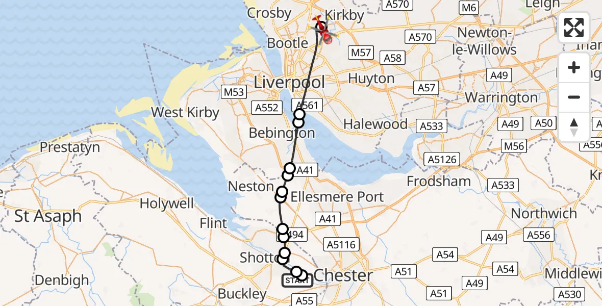
On Thursday, 29 January 2026 at 15:54, a Air Ambulance Helicopter departed from Hawarden Airport to Aintree University Hospital Heliport. It was the Air Ambulance Helicopter with registration number G-WENU. The flight lasted 14 minutes. During that period, the aircraft travelled 22 miles at an average speed of 98 miles per hour at a maximum altitude of 1550 feet.
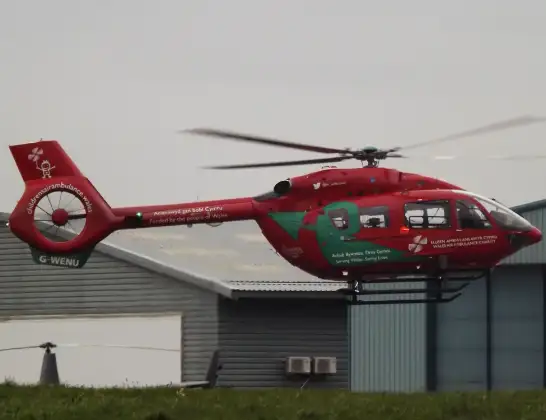
Helicopter: G-WENU
The helicopter G-WENU is used as a air ambulance helicopter. The main purpose of this aircraft is to transport a Mobile Medical Team to an incident as quickly as possible, enabling the trauma doctor to provide immediate first aid on site. The aircraft is flying this flight as Air Ambulance Helicopter.
Photo: James from Cheltenham, Gloucestershire
23 miles
1550 feet
98 mph
14 minutes
15:54
16:08

Route
Aintree University Hospital Heliport, 16:08
Aintree University Hospital Heliport16:07
Liverpool, Liverpool City Region16:03
New Ferry, Wirral16:02
Bromborough, Wirral16:01
Wirral, Liverpool City Region16:01
Willaston16:00
Chester16:00
Puddington15:59
Shotton15:59
Sealand15:58
Garden City15:58
Sandycroft15:57
Saltney Ferry15:57
Hawarden Airport, Broughton15:54
Today
Police Helicopter to Epping Forest, Green Lane26 Feb 23:43
Helicopter flights on your website?
You can easily display helicopter flights on your own website. Use the embed code.
