Air Ambulance Helicopter to Aintree University Hospital Heliport
Thursday, 29 January 2026 | 14:38 | From Irish Sea
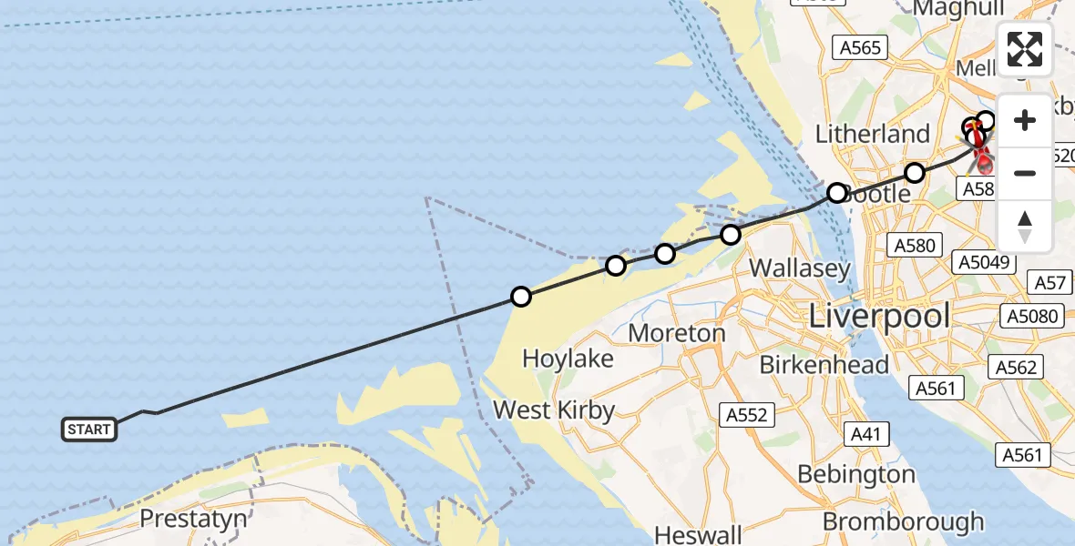
On Thursday, 29 January 2026 at 14:38, a Air Ambulance Helicopter departed from Irish Sea to Aintree University Hospital Heliport. It was the Air Ambulance Helicopter with registration number G-NWEM. The flight lasted 13 minutes. During that period, the aircraft travelled 25 miles at an average speed of 113 miles per hour at a maximum altitude of 1525 feet.
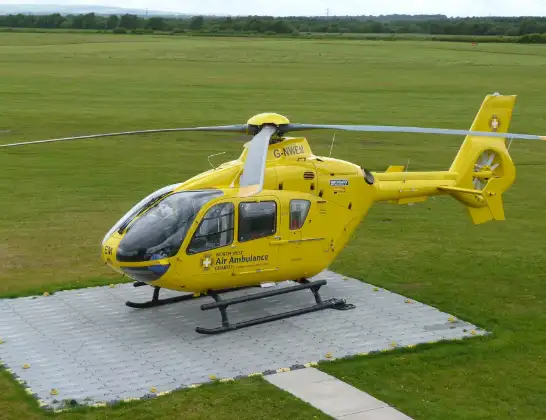
Helicopter: G-NWEM
The helicopter G-NWEM is used as a air ambulance helicopter. The main purpose of this aircraft is to transport a Mobile Medical Team to an incident as quickly as possible, enabling the trauma doctor to provide immediate first aid on site. The aircraft is flying this flight as Air Ambulance Helicopter.
Photo: Craig Sunter
25 miles
1525 feet
113 mph
14 minutes
14:38
14:51

Route
Aintree University Hospital Heliport, 14:51
Liverpool, Liverpool City Region14:51
Litherland, Liverpool14:50
Sefton, Liverpool City Region14:50
Liverpool, Liverpool City Region14:49
Sefton, Bootle14:48
Wallasey, Wirral14:46
Leasowe, Wirral14:45
Great Meols, Wirral14:45
Hoylake, Wirral14:43
Irish Sea, 14:38
Live flights
Police Helicopter on its way from RAF Benson12 Jul 22:54
Police Helicopter on its way from Dundrod12 Jul 22:50
Today
Air Ambulance Helicopter to Glasgow Airport12 Jul 22:48
Police Helicopter to Walton Wood Airfield12 Jul 22:44
Air Ambulance Helicopter to Norwich Airport12 Jul 22:27
Air Ambulance Helicopter to Northrepps Aerodrome12 Jul 22:23
Helicopter flights on your website?
You can easily display helicopter flights on your own website. Use the embed code.
