Air Ambulance Helicopter to Wellesbourne, Church Walk
Thursday, 29 January 2026 | 11:47 | From Coventry Airport
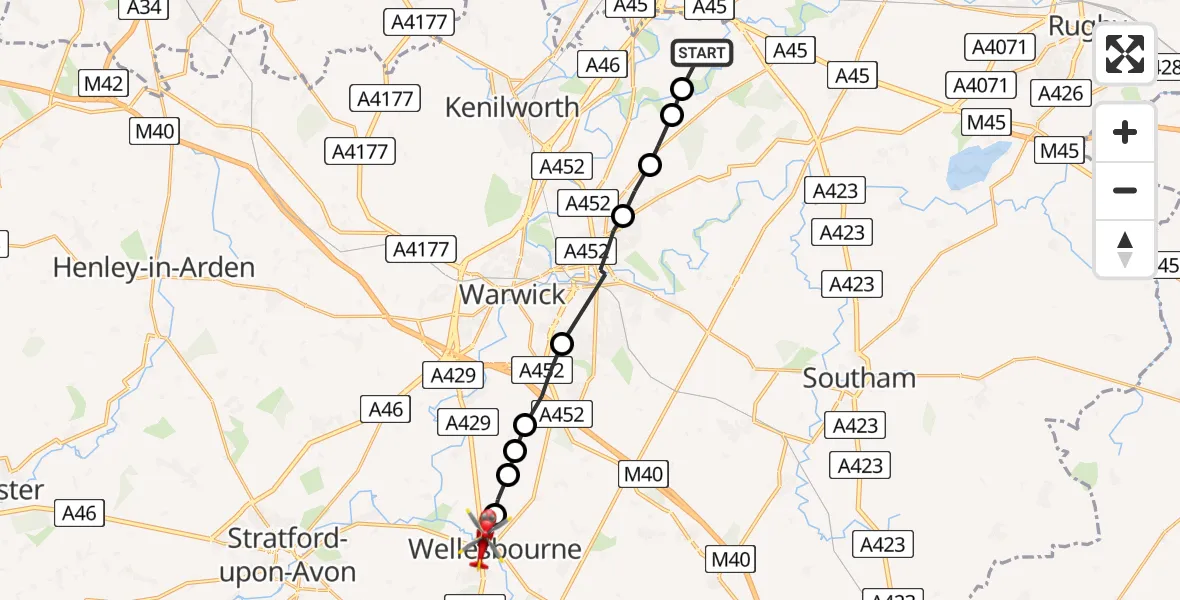
On Thursday, 29 January 2026 at 11:47, a Air Ambulance Helicopter departed from Coventry Airport to Wellesbourne. It was the Air Ambulance Helicopter with registration number G-WNAS. The flight lasted 6 minutes. During that period, the aircraft travelled 13 miles at an average speed of 146 miles per hour at a maximum altitude of 1550 feet.
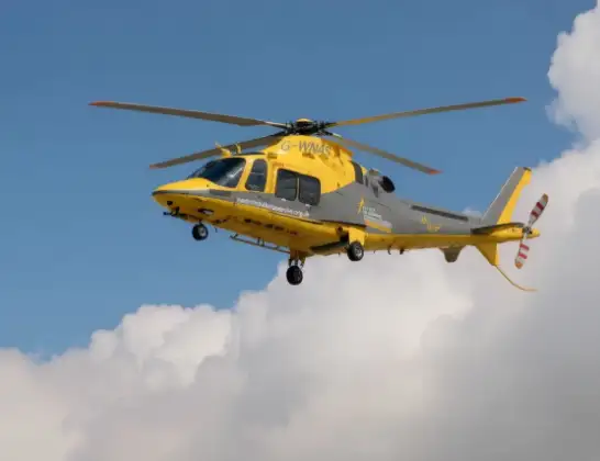
Helicopter: G-WNAS
The helicopter G-WNAS is used as an ambulance helicopter. The helicopter is equipped with a stretcher for transporting patients. The helicopter is often used to transport to hospitals.
Photo: Tony Melony
14 miles
1550 feet
146 mph
6 minutes
11:47
11:53

Route
Church Walk, Stratford-on-Avon11:53
Wellesbourne, Stratford-on-Avon11:52
Charlecote, Stratford-on-Avon11:51
Wasperton, Warwick11:51
Barford, Warwick11:51
Bishop's Tachbrook, Warwick11:50
Royal Leamington Spa11:49
Cubbington, Warwick11:48
Stoneleigh, Warwick11:48
Bubbenhall, Warwick11:47
Siskin Parkway West, Warwick11:47
Today
Police Helicopter to Epping Forest, Green Lane26 Feb 23:43
Flights Wellesbourne
Helicopter flights on your website?
You can easily display helicopter flights on your own website. Use the embed code.
