Air Ambulance Helicopter to YAA Nostell Helicopter Port, YAA Nostell Helicopter Port
Wednesday, 28 January 2026 | 8:56 | From Sheffield Northern Hospital
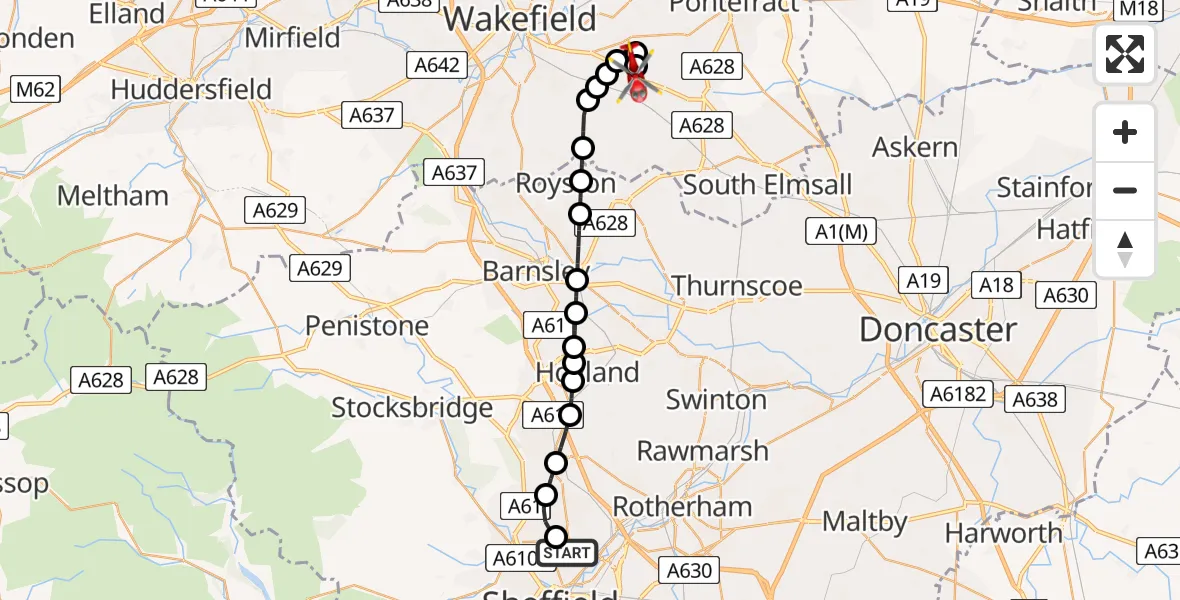
On Wednesday, 28 January 2026 at 8:56, a Air Ambulance Helicopter departed from Sheffield Northern Hospital to YAA Nostell Helicopter Port. It was the Air Ambulance Helicopter with registration number G-YORX. The flight lasted 11 minutes. During that period, the aircraft travelled 20 miles at an average speed of 111 miles per hour at a maximum altitude of 2175 feet.
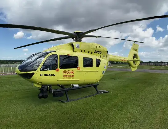
Helicopter: G-YORX
The helicopter G-YORX is used as a air ambulance helicopter. The main purpose of this aircraft is to transport a Mobile Medical Team to an incident as quickly as possible, enabling the trauma doctor to provide immediate first aid on site. The aircraft is flying this flight as Air Ambulance Helicopter.
Photo: Arollin96227
20 miles
2175 feet
111 mph
11 minutes
08:56
09:07

Route
YAA Nostell Helicopter Port, Foulby, Nostell, Yorkshire09:07
YAA Nostell Helicopter Port, Foulby, Nostell, Yorkshire09:07
YAA Nostell Helicopter Port, Foulby, Nostell, Yorkshire09:06
Nostell, Wakefield09:05
Sharlston, Wakefield09:05
New Crofton, Wakefield09:04
Crofton, Wakefield09:04
Wintersett, Wakefield09:04
Cold Hiendley, Wakefield09:03
Royston, South Yorkshire09:03
Carlton, Barnsley09:02
Cudworth, South Yorkshire09:01
Worsbrough, Barnsley09:01
Blacker Hill, Barnsley09:00
Upper Hoyland, Barnsley09:00
Hoyland, South Yorkshire09:00
Tankersley, Hoyland08:59
Chapeltown, Sheffield08:58
Whitley, Sheffield08:58
Sheffield, South Yorkshire08:57
Herries Road, South Yorkshire08:56
Live flights
Today
Helicopter flights on your website?
You can easily display helicopter flights on your own website. Use the embed code.
