Air Ambulance Helicopter to Harwell, A34
Tuesday, 27 January 2026 | 22:11 | From Kimpton
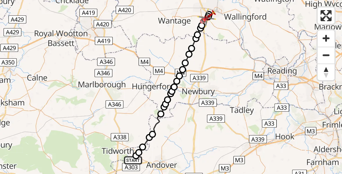
On Tuesday, 27 January 2026 at 22:11, a Air Ambulance Helicopter departed from Kimpton to Harwell. It was the Air Ambulance Helicopter with registration number G-HIOW. The flight lasted 14 minutes. During that period, the aircraft travelled 33 miles at an average speed of 147 miles per hour at a maximum altitude of 2675 feet.
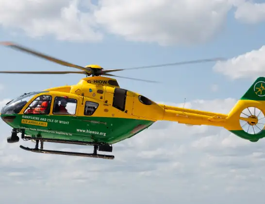
Helicopter: G-HIOW
The helicopter G-HIOW is used as a air ambulance helicopter. The main purpose of this aircraft is to transport a Mobile Medical Team to an incident as quickly as possible, enabling the trauma doctor to provide immediate first aid on site. The aircraft is flying this flight as Air Ambulance Helicopter.
Photo: JF2608
34 miles
2675 feet
147 mph
14 minutes
22:11
22:25

Route
Harwell, Vale of White Horse22:25
Harwell, Vale of White Horse22:25
A34, 22:25
Vale of White Horse22:25
Reading Road, Vale of White Horse22:24
Harwell, Vale of White Horse22:23
A34, 22:23
Harwell, Vale of White Horse22:22
Chilton, Vale of White Horse22:22
West Ilsley22:21
East Hendred22:21
West Ilsley22:20
Peasemore22:20
Leckhampstead22:19
Welford22:19
Easton22:18
Hoe Benham22:18
Welford22:17
Kintbury22:17
Hungerford22:17
Kintbury22:16
Inkpen22:16
West Woodhay22:16
Combe22:15
Vernhams Dean, Test Valley22:14
Tangley, Test Valley22:14
Chute Forest22:13
Appleshaw, Test Valley22:12
Faberstown, Test Valley22:12
Down Road, Test Valley22:11
Live flights
Today
Police Helicopter to Epping Forest, Green Lane26 Feb 23:43
Flights Harwell
Air Ambulance Helicopter to Harwell, A3427 Jan 22:11
Flights Kimpton
Air Ambulance Helicopter to Kimpton, Down Road24 Feb 17:20
Air Ambulance Helicopter to Kimpton, Down Road15 Feb 00:14
to Kimpton, Ox Drove1 Feb 12:23
Helicopter flights on your website?
You can easily display helicopter flights on your own website. Use the embed code.
