Police Helicopter to Harborough, Sulby Road
Tuesday, 27 January 2026 | 18:07 | From Stoke Golding
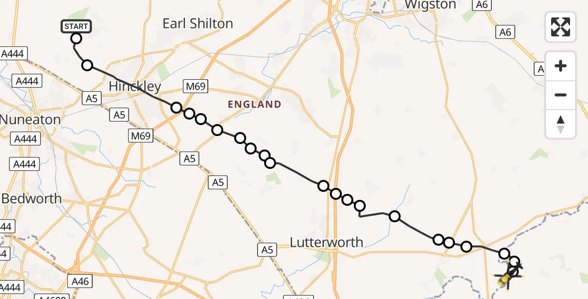
On Tuesday, 27 January 2026 at 18:07, a Police Helicopter departed from Stoke Golding to Harborough. It was the Police Helicopter with registration number G-SUFK. The flight lasted 11 minutes. During that period, the aircraft travelled 21 miles at an average speed of 116 miles per hour at a maximum altitude of 2200 feet.
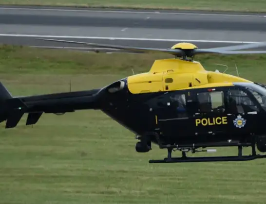
Helicopter: G-SUFK
The helicopter G-SUFK is used by the British police. The helicopter is deployed in pursuits, missing persons cases and other incidents where a helicopter provides added value.
Photo: Alec Wilson
21 miles
2200 feet
116 mph
11 minutes
18:07
18:17

Route
Sulby Road, 18:17
Husbands Bosworth Airfield, Lutterworth, Leicestershire18:17
Sibbertoft18:17
Marston Trussell18:16
Husbands Bosworth, Harborough18:15
North Kilworth, Harborough18:15
Harborough18:15
Kimcote and Walton, Harborough18:14
Gilmorton, Harborough18:13
Harborough18:13
Gilmorton, Harborough18:13
Ashby Parva18:13
Ashby Parva, Harborough18:12
Frolesworth, Harborough18:11
Harborough18:11
Claybrooke Farm Airstrip18:11
Sharnford18:11
Blaby18:10
Aston Flamville18:10
Stretton Baskerville, Hinckley and Bosworth18:10
Hinckley, Hinckley and Bosworth18:08
Higham on the Hill, Hinckley and Bosworth18:07
Upton Lane, Hinckley and Bosworth18:07
Live flights
Air Ambulance Helicopter on its way from Devizes14 Jul 22:59
Police Helicopter on its way from Thames View14 Jul 22:44
Police Helicopter on its way from Brandy Carr14 Jul 22:00
Today
Air Ambulance Helicopter to Cardiff Heliport14 Jul 22:43
Coastguard Helicopter to North Sea14 Jul 22:40
Air Ambulance Helicopter to North Sea14 Jul 22:27
Air Ambulance Helicopter to Priory Farm Airstrip14 Jul 22:16
Air Ambulance Helicopter to Papworth Hospital14 Jul 22:02
Air Ambulance Helicopter to Redhill Aerodrome14 Jul 21:58
Coastguard Helicopter to North Sea14 Jul 21:56
Flights Harborough
Police Helicopter to Harborough, Sulby Road14 Jul 18:00
Police Helicopter to Harborough, Sulby Road14 Jul 16:16
Police Helicopter to Harborough, Sulby Road14 Jul 11:00
Police Helicopter to Harborough, Sulby Road14 Jul 10:43
Police Helicopter to Harborough, Sulby Road13 Jul 23:36
Police Helicopter to Harborough, Sulby Road13 Jul 21:30
Police Helicopter to Harborough, Sulby Road13 Jul 17:25
Police Helicopter to Harborough, Sulby Road12 Jul 22:20
Police Helicopter to Harborough, Sulby Road12 Jul 20:10
Police Helicopter to Harborough, Sulby Road12 Jul 18:05
Helicopter flights on your website?
You can easily display helicopter flights on your own website. Use the embed code.
