Coastguard Helicopter to North Atlantic Ocean
Tuesday, 27 January 2026 | 14:47 | From Hilton of Cadboll
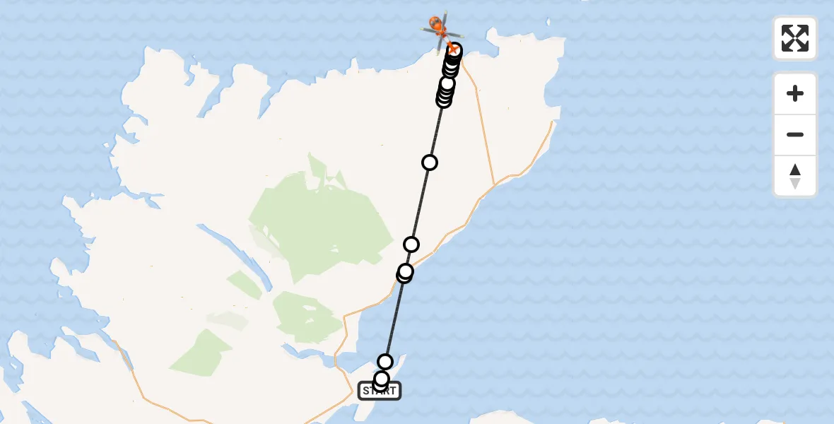
On Tuesday, 27 January 2026 at 14:47, a Coastguard Helicopter departed from Hilton of Cadboll to North Atlantic Ocean. It was the Coastguard Helicopter with registration number G-MCGT. The flight lasted 23 minutes. During that period, the aircraft travelled 62 miles at an average speed of 161 miles per hour at a maximum altitude of 5775 feet.

Helicopter: G-MCGT
The helicopter G-MCGT is used by the British Coastguard. The helicopter is deployed in search and rescue operations at sea, rescue operations involving ships or drilling platforms, patrols to prevent smuggling or piracy, environmental monitoring and disaster relief support.
Photo: Ronnie Macdonald
63 miles
5775 feet
161 mph
24 minutes
14:47
15:10

Route
North Atlantic Ocean, 15:10
North Atlantic Ocean15:09
Scrabster15:08
Thurso15:08
Newlands of Geise15:08
Glengolly15:08
Newlands of Geise15:07
Westfield15:07
Lieurary15:06
Loch Calder15:06
Tornameal15:06
Loch Calder15:06
Tornameal15:05
Dalnawillan Lodge15:02
Torrish14:57
Portgower14:55
Lothbeg14:55
North Sea14:49
Inver14:48
Portmahomack14:47
Hilton of Cadboll, 14:47
Live flights
Today
Helicopter flights on your website?
You can easily display helicopter flights on your own website. Use the embed code.
