Air Ambulance Helicopter to Worcester, Charles Hastings Way
Tuesday, 27 January 2026 | 12:14 | From Hampton Bishop
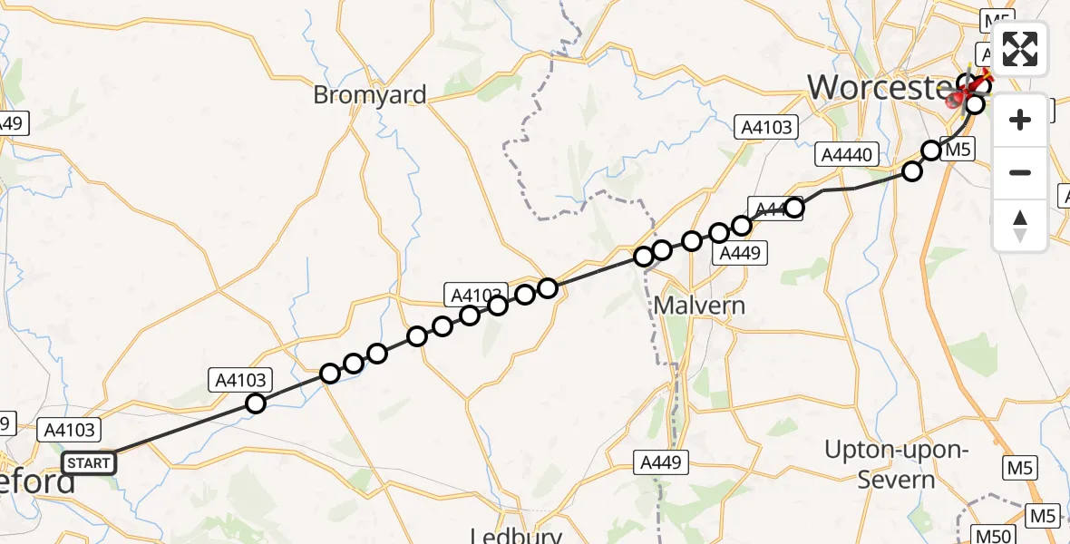
On Tuesday, 27 January 2026 at 12:14, a Air Ambulance Helicopter departed from Hampton Bishop to Worcester. It was the Air Ambulance Helicopter with registration number G-OMAA. The flight lasted 10 minutes. During that period, the aircraft travelled 24 miles at an average speed of 142 miles per hour at a maximum altitude of 2625 feet.

Helicopter: G-OMAA
The helicopter G-OMAA is used as a air ambulance helicopter. The main purpose of this aircraft is to transport a Mobile Medical Team to an incident as quickly as possible, enabling the trauma doctor to provide immediate first aid on site. The aircraft is flying this flight as Air Ambulance Helicopter.
Photo: James from Cheltenham, Gloucestershire
25 miles
2625 feet
142 mph
11 minutes
12:14
12:24

Route
Charles Hastings Way, 12:24
Worcester12:24
Tibberton, Wychavon12:24
Worcester12:23
Wychavon12:23
Kempsey, Malvern Hills12:22
Powick, Malvern Hills12:21
Newland, Malvern Hills12:21
Leigh Sinton, Malvern Hills12:20
Malvern, Malvern Hills12:20
Crumpton Oaks Farm Airstrip, Storridge12:20
Storridge12:20
Cradley12:19
Mathon12:18
Fromes Hill12:18
Bishop's Frome12:18
Fromes Hill12:18
Bosbury12:17
Ashperton12:17
Much Cowarne12:17
Stretton Grandison12:16
Yarkhill12:16
A438, 12:14
Live flights
Air Ambulance Helicopter on its way from Ashford14 Jul 23:46
Coastguard Helicopter on its way from North Sea14 Jul 23:44
Police Helicopter on its way from Inner Seas14 Jul 23:38
Today
Coastguard Helicopter to North Sea14 Jul 23:30
Police Helicopter to Inner Seas14 Jul 23:12
Air Ambulance Helicopter to Norwich Airport14 Jul 22:52
Police Helicopter to Manchester Barton Aerodrome14 Jul 22:50
Police Helicopter to Sewardstonebury, Bury Road14 Jul 22:44
Air Ambulance Helicopter to Cardiff Heliport14 Jul 22:43
Coastguard Helicopter to North Sea14 Jul 22:40
Flights Worcester
Helicopter flights on your website?
You can easily display helicopter flights on your own website. Use the embed code.
