Coastguard Helicopter to Higher Eype, Offical Bridleway (You should use this) W18/36
Monday, 26 January 2026 | 19:56 | From Bridport
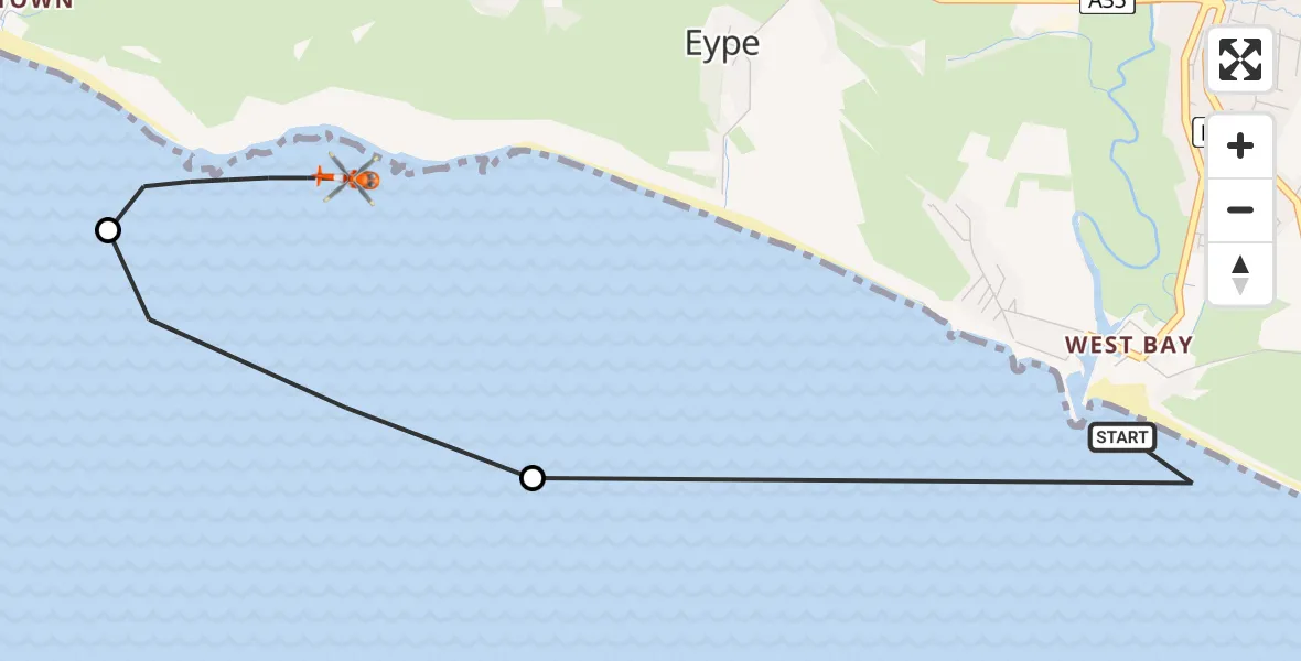
On Monday, 26 January 2026 at 19:56, a Coastguard Helicopter departed from Bridport to Higher Eype. It was the Coastguard Helicopter with registration number G-RESF. The flight lasted 4 minutes. During that period, the aircraft travelled 4 miles at an average speed of 58 miles per hour at a maximum altitude of 950 feet.

Helicopter: G-RESF
The helicopter G-RESF is used by the British Coastguard. The helicopter is deployed in search and rescue operations at sea, rescue operations involving ships or drilling platforms, patrols to prevent smuggling or piracy, environmental monitoring and disaster relief support.
Photo: Tony Melony
4 miles
950 feet
58 mph
4 minutes
19:56
20:00

Route
Offical Bridleway (You should use this) W18/36, 20:00
Seatown19:59
English Channel19:58
Station Road, 19:56
Today
Flights Bridport
Police Helicopter to Bridport, Burton Road28 Apr 17:16
Police Helicopter to Bridport, Burton Road28 Apr 17:12
Police Helicopter to Bridport, Burton Bradstock28 Apr 16:44
Police Helicopter to Bridport, Burton Road28 Apr 14:58
Police Helicopter to Bridport28 Apr 14:02
Helicopter flights on your website?
You can easily display helicopter flights on your own website. Use the embed code.
