Police Helicopter to Pangbourne, Riverview Road
Monday, 26 January 2026 | 18:36 | From South Oxfordshire
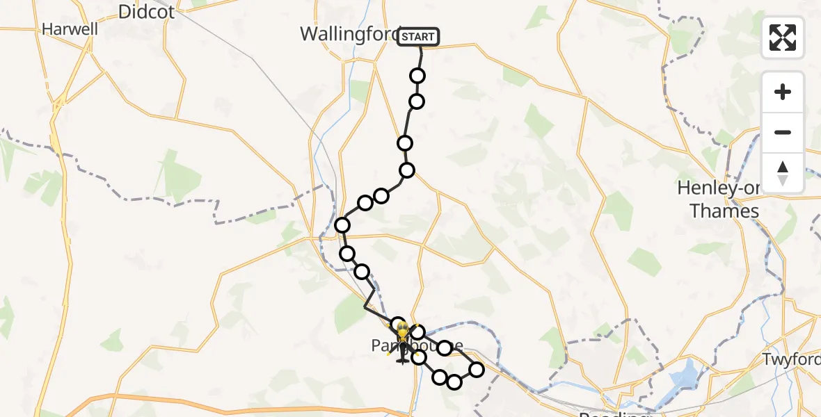
On Monday, 26 January 2026 at 18:36, a Police Helicopter departed from South Oxfordshire to Pangbourne. It was the Police Helicopter with registration number G-POLF. The flight lasted 7 minutes. During that period, the aircraft travelled 14 miles at an average speed of 117 miles per hour at a maximum altitude of 1500 feet.
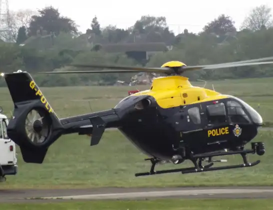
Helicopter: G-POLF
The helicopter G-POLF is used by the British police. The helicopter is deployed in pursuits, missing persons cases and other incidents where a helicopter provides added value.
Photo: James
14 miles
1500 feet
117 mph
8 minutes
18:36
18:43

Route
Riverview Road, 18:43
Pangbourne18:43
Sulham18:42
Little Heath18:42
Tilehurst18:42
Purley on Thames18:41
Whitchurch-on-Thames, South Oxfordshire18:41
Pangbourne18:41
Lower Basildon18:40
Goring-on-Thames, South Oxfordshire18:39
Goring-on-Thames, Reading18:39
Goring-on-Thames, South Oxfordshire18:38
South Oxfordshire18:38
Woodcote, South Oxfordshire18:38
South Stoke, South Oxfordshire18:37
Ipsden, South Oxfordshire18:37
Crowmarsh Gifford, South Oxfordshire18:36
South Oxfordshire, 18:36
Today
Police Helicopter to Epping Forest, Green Lane26 Feb 23:43
Flights Pangbourne
Police Helicopter to Pangbourne, Riverview Road26 Jan 18:36
Helicopter flights on your website?
You can easily display helicopter flights on your own website. Use the embed code.
