Air Ambulance Helicopter to North Luffenham, Edith Weston Road
Monday, 26 January 2026 | 15:44 | From Hickling
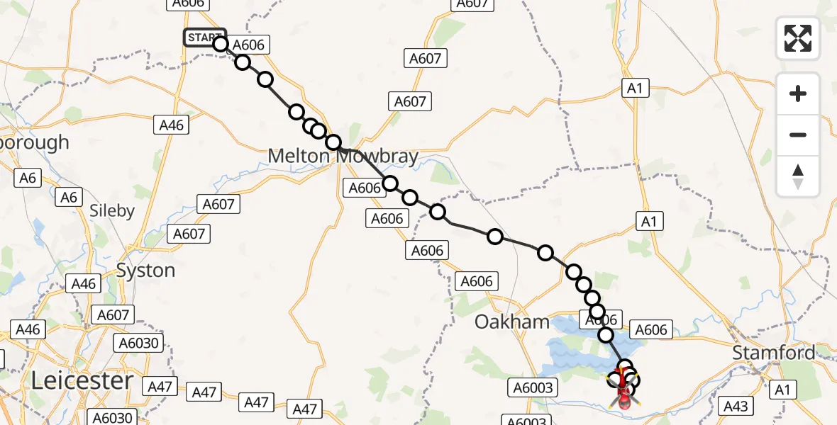
On Monday, 26 January 2026 at 15:44, a Air Ambulance Helicopter departed from Hickling to North Luffenham. It was the Air Ambulance Helicopter with registration number G-DRLA. The flight lasted 11 minutes. During that period, the aircraft travelled 26 miles at an average speed of 139 miles per hour at a maximum altitude of 1475 feet.
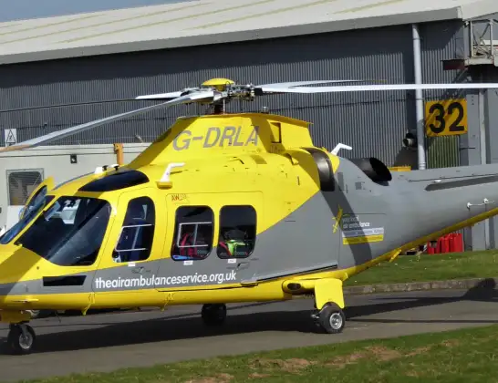
Helicopter: G-DRLA
The helicopter G-DRLA is used as an ambulance helicopter. The helicopter is equipped with a stretcher for transporting patients. The helicopter is often used to transport to hospitals.
Photo: Alec Wilson
26 miles
1475 feet
139 mph
12 minutes
15:44
15:56

Route
Edith Weston Road, 15:56
Edith Weston15:55
North Luffenham15:54
RAF North Luffenham, Oakham, Rutland15:54
Edith Weston15:54
Empingham15:53
Rutland Water15:53
Whitwell15:52
Exton15:52
Exton and Horn15:52
Burley15:52
Cottesmore15:51
Ashwell15:50
Whissendine15:49
Melton15:49
Burton Lazars, Melton15:48
Melton Mowbray, Melton15:47
Sysonby, Melton15:47
Melton Mowbray, Melton15:47
Wartnaby, Melton15:46
Ab Kettleby, Melton15:46
Queensway Old Dalby, Melton15:45
Upper Broughton, Rushcliffe15:45
Folly Hall Lane, Rushcliffe15:44
Live flights
Today
Flights Hickling
Air Ambulance Helicopter to Nottingham Heliport26 Jul 20:01
Air Ambulance Helicopter to Eakring CP22 Jul 16:24
Air Ambulance Helicopter to Nottingham Heliport22 Jul 07:54
Helicopter flights on your website?
You can easily display helicopter flights on your own website. Use the embed code.
