Police Helicopter to Great Bookham, West Down
Monday, 26 January 2026 | 14:34 | From Redhill Aerodrome
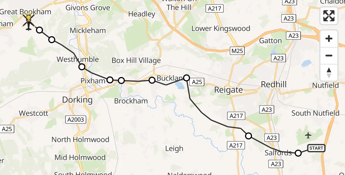
On Monday, 26 January 2026 at 14:34, a Police Helicopter departed from Redhill Aerodrome to Great Bookham. It was the Police Helicopter with registration number G-POLH. The flight lasted 6 minutes. During that period, the aircraft travelled 12 miles at an average speed of 134 miles per hour at a maximum altitude of 1400 feet.
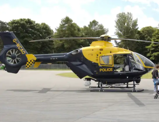
Helicopter: G-POLH
The helicopter G-POLH is used by the British police. The helicopter is deployed in pursuits, missing persons cases and other incidents where a helicopter provides added value.
Photo: Arpingstone
13 miles
1400 feet
134 mph
6 minutes
14:34
14:39

Route
West Down, Mole Valley14:39
Great Bookham, Mole Valley14:39
Hawk's Hill, Mole Valley14:39
Westhumble, Mole Valley14:38
Pixham, Mole Valley14:38
Brockham, Mole Valley14:38
Betchworth, Mole Valley14:37
Buckland, Mole Valley14:36
Reigate, Reigate and Banstead14:35
Salfords, Reigate and Banstead14:34
Moats Lane, 14:34
Today
Police Helicopter to Epping Forest, Green Lane26 Feb 23:43
Helicopter flights on your website?
You can easily display helicopter flights on your own website. Use the embed code.
