Police Helicopter to West Devon, Two Post Lane
Sunday, 25 January 2026 | 21:49 | From East Devon
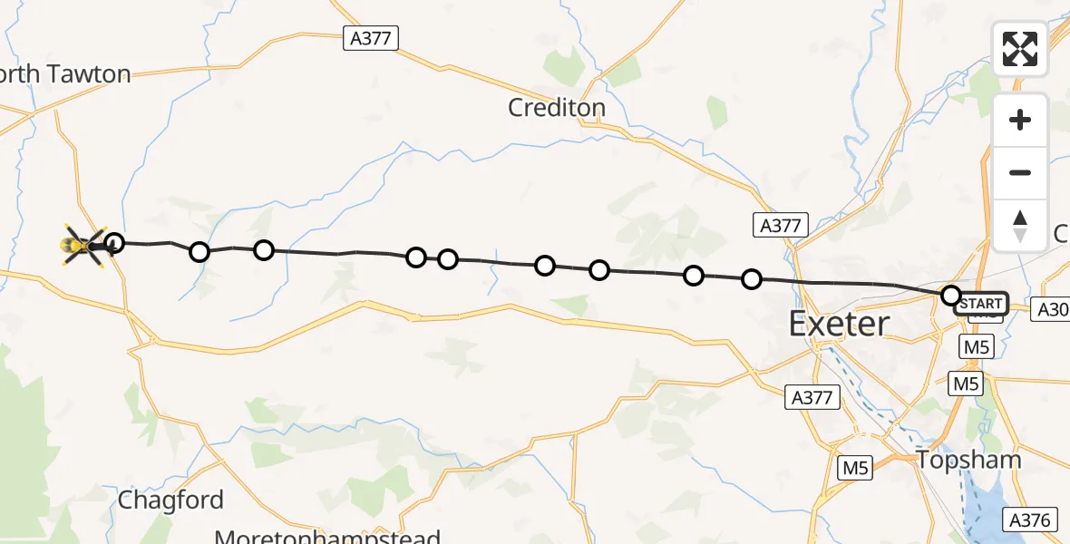
On Sunday, 25 January 2026 at 21:49, a Police Helicopter departed from East Devon to West Devon. It was the Police Helicopter with registration number G-CPAS. The flight lasted 7 minutes. During that period, the aircraft travelled 18 miles at an average speed of 149 miles per hour at a maximum altitude of 2200 feet.

Helicopter: G-CPAS
The helicopter G-CPAS is used by the British police. The helicopter is deployed in pursuits, missing persons cases and other incidents where a helicopter provides added value.
19 miles
2200 feet
149 mph
8 minutes
21:49
21:56

Route
Two Post Lane, Devon and Torbay21:56
West Devon, Devon and Torbay21:56
Spreyton, West Devon21:55
Hittisleigh, Mid Devon21:55
Mid Devon, Devon and Torbay21:54
Teignbridge, Devon and Torbay21:53
Tedburn St Mary, Teignbridge21:53
Pathfinder Village, Teignbridge21:52
Whitestone, Teignbridge21:51
Nadderwater, Teignbridge21:51
Exeter, Devon and Torbay21:49
Blackhorse Lane, Devon and Torbay21:49
Live flights
Today
Helicopter flights on your website?
You can easily display helicopter flights on your own website. Use the embed code.
