Police Helicopter to MOD St Athan
Sunday, 25 January 2026 | 19:43 | From St Athan
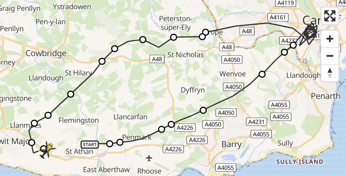
On Sunday, 25 January 2026 at 19:43, a Police Helicopter departed from St Athan to MOD St Athan. It was the Police Helicopter with registration number G-NWOI. The flight lasted 24 minutes. During that period, the aircraft travelled 38 miles at an average speed of 97 miles per hour at a maximum altitude of 1800 feet.

Helicopter: G-NWOI
The helicopter G-NWOI is used by the British police. The helicopter is deployed in pursuits, missing persons cases and other incidents where a helicopter provides added value.
Photo: James from Cheltenham
39 miles
1800 feet
97 mph
24 minutes
19:43
20:07

Route
MOD St Athan, St Athan, Vale of Glamorgan20:07
MOD St Athan, St Athan, Vale of Glamorgan20:06
Boverton20:06
Llanmaes20:05
Eglwys Brewis20:05
St Mary Church20:05
St Hilary20:04
Welsh St. Donats20:03
Pendoylan20:03
Peterston-super-Ely20:03
St Nicholas20:02
Drope20:02
Cardiff19:48
Llandough19:48
Michaelston-le-Pit19:47
Wenvoe19:46
Dyffryn19:45
Llancarfan19:45
Penmark19:44
Llancarfan19:43
Castleton Road, 19:43
Live flights
Today
Helicopter flights on your website?
You can easily display helicopter flights on your own website. Use the embed code.
