Air Ambulance Helicopter to Norwich Airport
Sunday, 25 January 2026 | 17:20 | From Gorleston-on-Sea
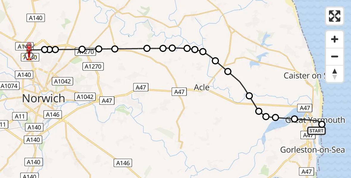
On Sunday, 25 January 2026 at 17:20, a Air Ambulance Helicopter departed from Gorleston-on-Sea to Norwich Airport. It was the Air Ambulance Helicopter with registration number G-HEMC. The flight lasted 14 minutes. During that period, the aircraft travelled 23 miles at an average speed of 95 miles per hour at a maximum altitude of 2450 feet.

Helicopter: G-HEMC
The helicopter G-HEMC is used as a air ambulance helicopter. The main purpose of this aircraft is to transport a Mobile Medical Team to an incident as quickly as possible, enabling the trauma doctor to provide immediate first aid on site. The aircraft is flying this flight as Air Ambulance Helicopter.
Photo: Jsmauger
23 miles
2450 feet
95 mph
15 minutes
17:20
17:34

Route
Norwich Airport, Norwich, Norfolk17:34
Norwich Airport, Norwich, Norfolk17:34
Norwich Airport, Norwich, Norfolk17:31
Broadland17:30
Spixworth, Broadland17:30
Beeston St Andrew, Broadland17:29
Rackheath, Broadland17:29
Salhouse, Broadland17:28
Woodbastwick, Broadland17:27
Panxworth, Broadland17:27
Broadland17:26
South Walsham, Broadland17:26
Broadland17:26
Upton, Broadland17:25
Great Yarmouth17:25
Fleggburgh, Great Yarmouth17:24
Stokesby with Herringby, Great Yarmouth17:23
Halvergate, Broadland17:23
Great Yarmouth17:23
Halvergate, Broadland17:22
Breydon Water17:22
Great Yarmouth17:21
Frank Stone Court, 17:20
Live flights
Police Helicopter on its way from Renfrew15 Jul 23:02
Today
Police Helicopter to Coopersale, Epping Road15 Jul 23:07
Air Ambulance Helicopter to Dunkeswell Airfield15 Jul 23:01
Police Helicopter to Manchester Barton Aerodrome15 Jul 22:25
Police Helicopter to Baxterley Aerodrome15 Jul 22:24
Air Ambulance Helicopter to Henstridge Airfield15 Jul 22:14
Coastguard Helicopter to Argyll and Bute, B84515 Jul 22:05
Police Helicopter to MOD St Athan15 Jul 21:51
Flights Gorleston-on-Sea
Helicopter flights on your website?
You can easily display helicopter flights on your own website. Use the embed code.
