Air Ambulance Helicopter to Chaddesley Corbett, Kidderminster Road
Sunday, 25 January 2026 | 16:37 | From Earl's Croome
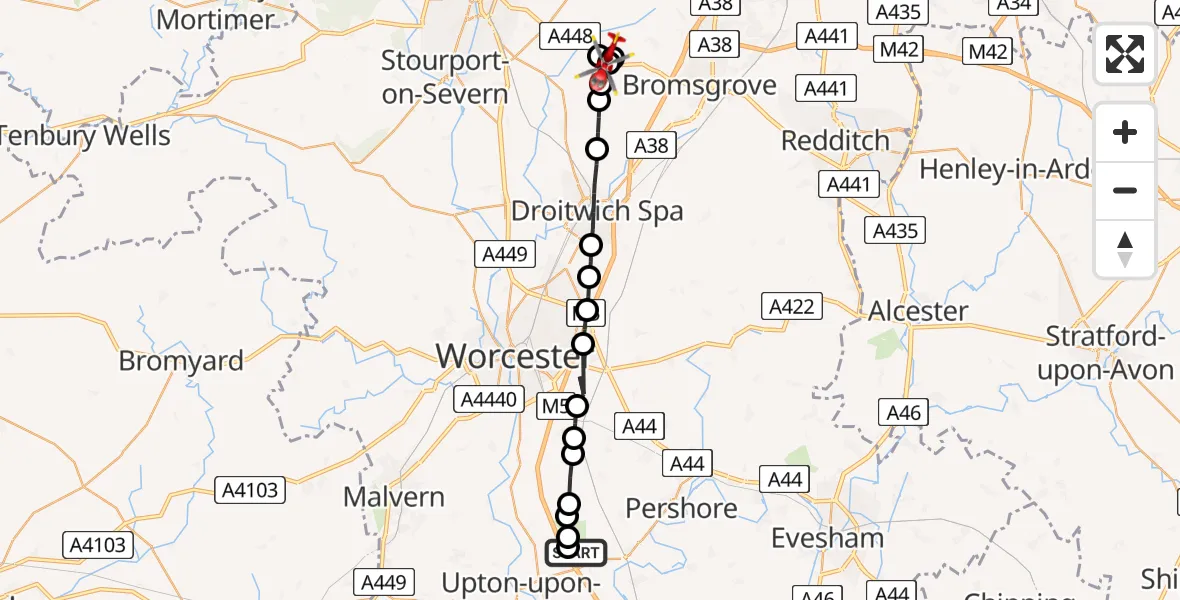
On Sunday, 25 January 2026 at 16:37, a Air Ambulance Helicopter departed from Earl's Croome to Chaddesley Corbett. It was the Air Ambulance Helicopter with registration number G-OMAA. The flight lasted 9 minutes. During that period, the aircraft travelled 21 miles at an average speed of 141 miles per hour at a maximum altitude of 1875 feet.
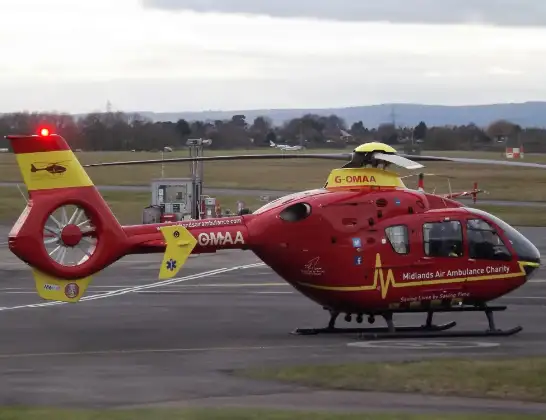
Helicopter: G-OMAA
The helicopter G-OMAA is used as a air ambulance helicopter. The main purpose of this aircraft is to transport a Mobile Medical Team to an incident as quickly as possible, enabling the trauma doctor to provide immediate first aid on site. The aircraft is flying this flight as Air Ambulance Helicopter.
Photo: James from Cheltenham, Gloucestershire
21 miles
1875 feet
141 mph
9 minutes
16:37
16:46

Route
Kidderminster Road, Wyre Forest16:46
Chaddesley Corbett, Wyre Forest16:46
Bromsgrove16:46
Chaddesley Corbett, Wyre Forest16:45
Elmbridge, Wychavon16:45
Upton Warren, Wychavon16:45
Elmbridge, Wychavon16:44
Droitwich Spa, Wychavon16:42
Martin Hussingtree, Wychavon16:42
Wychavon16:41
Tibberton, Wychavon16:41
Wychavon16:40
Littleworth, Worcester16:39
Kempsey, Worcester16:39
Pirton, Wychavon16:38
Malvern Hills16:38
Kinnersley, Malvern Hills16:38
Severn Stoke, Malvern Hills16:38
Earl's Croome, Malvern Hills16:37
Live flights
Today
Police Helicopter to Manchester Barton Aerodrome13 Jul 23:56
Police Helicopter to Bournemouth Airport13 Jul 23:55
Air Ambulance Helicopter to Cardiff Heliport13 Jul 23:38
Police Helicopter to Harborough, Sulby Road13 Jul 23:36
Police Helicopter to Birmingham Airport13 Jul 23:21
Helicopter flights on your website?
You can easily display helicopter flights on your own website. Use the embed code.
