Police Helicopter to MOD St Athan
Sunday, 25 January 2026 | 15:36 | From St. Athan
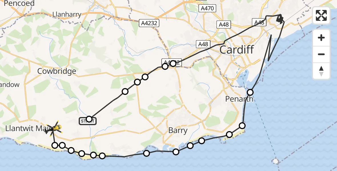
On Sunday, 25 January 2026 at 15:36, a Police Helicopter departed from St. Athan to MOD St Athan. It was the Police Helicopter with registration number G-NWOI. The flight lasted 48 minutes. During that period, the aircraft travelled 52 miles at an average speed of 65 miles per hour at a maximum altitude of 1800 feet.

Helicopter: G-NWOI
The helicopter G-NWOI is used by the British police. The helicopter is deployed in pursuits, missing persons cases and other incidents where a helicopter provides added value.
Photo: James from Cheltenham
53 miles
1800 feet
65 mph
49 minutes
15:36
16:24

Route
MOD St Athan, St Athan, Vale of Glamorgan16:24
Boverton16:24
MOD St Athan, St Athan, Vale of Glamorgan16:24
St Athan16:23
West Aberthaw16:23
Rhoose16:23
East Aberthaw16:23
Rhoose16:22
Barry16:21
Sully and Lavernock16:21
Barry16:20
Sully16:20
Sully and Lavernock16:19
Penarth16:18
Cardiff15:39
Drope15:39
St Nicholas15:38
Bonvilston15:38
St Nicholas and Bonvilston15:38
Llancarfan15:36
St. Athan, 15:36
Live flights
Today
Helicopter flights on your website?
You can easily display helicopter flights on your own website. Use the embed code.
