Air Ambulance Helicopter to North Sea, North Sea
Sunday, 25 January 2026 | 14:48 | From RIE Rooftop
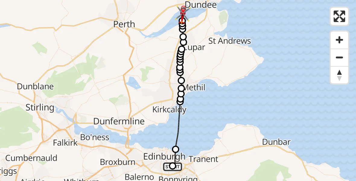
On Sunday, 25 January 2026 at 14:48, a Air Ambulance Helicopter departed from RIE Rooftop to North Sea. It was the Air Ambulance Helicopter with registration number G-GSAS. The flight lasted 16 minutes. During that period, the aircraft travelled 35 miles at an average speed of 137 miles per hour at a maximum altitude of 1500 feet.
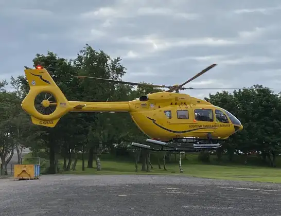
Helicopter: G-GSAS
The helicopter G-GSAS is used as a air ambulance helicopter. The main purpose of this aircraft is to transport a Mobile Medical Team to an incident as quickly as possible, enabling the trauma doctor to provide immediate first aid on site. The aircraft is flying this flight as Air Ambulance Helicopter.
Photo: Scanbus
36 miles
1500 feet
137 mph
16 minutes
14:48
15:04

Route
North Sea, 15:04
North Sea15:03
Luthrie15:03
Balhelvie15:03
Hazelton Walls15:02
Luthrie15:02
Cupar15:01
Over Rankeilour15:00
Springfield15:00
Rankeilour15:00
Pitlessie15:00
Ladybank14:59
Pitlessie14:59
Kingskettle14:59
Kettlebridge14:58
Rameldry Mill14:58
Star14:57
Milton of Balgonie14:57
Windygates14:56
Coaltown of Wemyss14:56
West Wemyss14:55
North Sea14:51
City of Edinburgh14:48
Little France Crescent, 14:48
Today
Police Helicopter to Epping Forest, Green Lane26 Feb 23:43
Helicopter flights on your website?
You can easily display helicopter flights on your own website. Use the embed code.
