Air Ambulance Helicopter to Glenegedale, Low Road
Sunday, 25 January 2026 | 13:39 | From Glasgow Airport
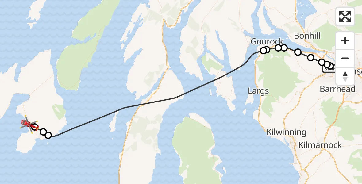
On Sunday, 25 January 2026 at 13:39, a Air Ambulance Helicopter departed from Glasgow Airport to Glenegedale. It was the Air Ambulance Helicopter with registration number G-ISAS. The flight lasted 30 minutes. During that period, the aircraft travelled 77 miles at an average speed of 157 miles per hour at a maximum altitude of 2325 feet.
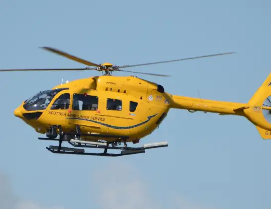
Helicopter: G-ISAS
The helicopter G-ISAS is used as a air ambulance helicopter. The main purpose of this aircraft is to transport a Mobile Medical Team to an incident as quickly as possible, enabling the trauma doctor to provide immediate first aid on site. The aircraft is flying this flight as Air Ambulance Helicopter.
Photo: Jonathan Payne
78 miles
2325 feet
157 mph
30 minutes
13:39
14:08

Route
Low Road, 14:08
Glenegedale14:08
Port Ellen14:07
Lagavulin14:07
Inner Seas13:46
Braeside13:46
Greenock13:45
Inner Seas13:44
Port Glasgow13:43
Langbank13:42
Bishopton13:41
Erskine13:40
Inchinnan13:39
Glasgow Airport, Glasgow13:39
Live flights
Today
Police Helicopter to Epping Forest, Green Lane26 Feb 23:43
Flights Glenegedale
Air Ambulance Helicopter to Royal Alexandria Hospital Paisley, Royal Alexandria Hospital Paisley17 Feb 14:46
Air Ambulance Helicopter to Royal Alexandria Hospital Paisley, Royal Alexandria Hospital Paisley3 Feb 14:17
Helicopter flights on your website?
You can easily display helicopter flights on your own website. Use the embed code.
