Police Helicopter to Coleshill Heath, Blackfirs Lane
Sunday, 25 January 2026 | 12:34 | From Bickenhill
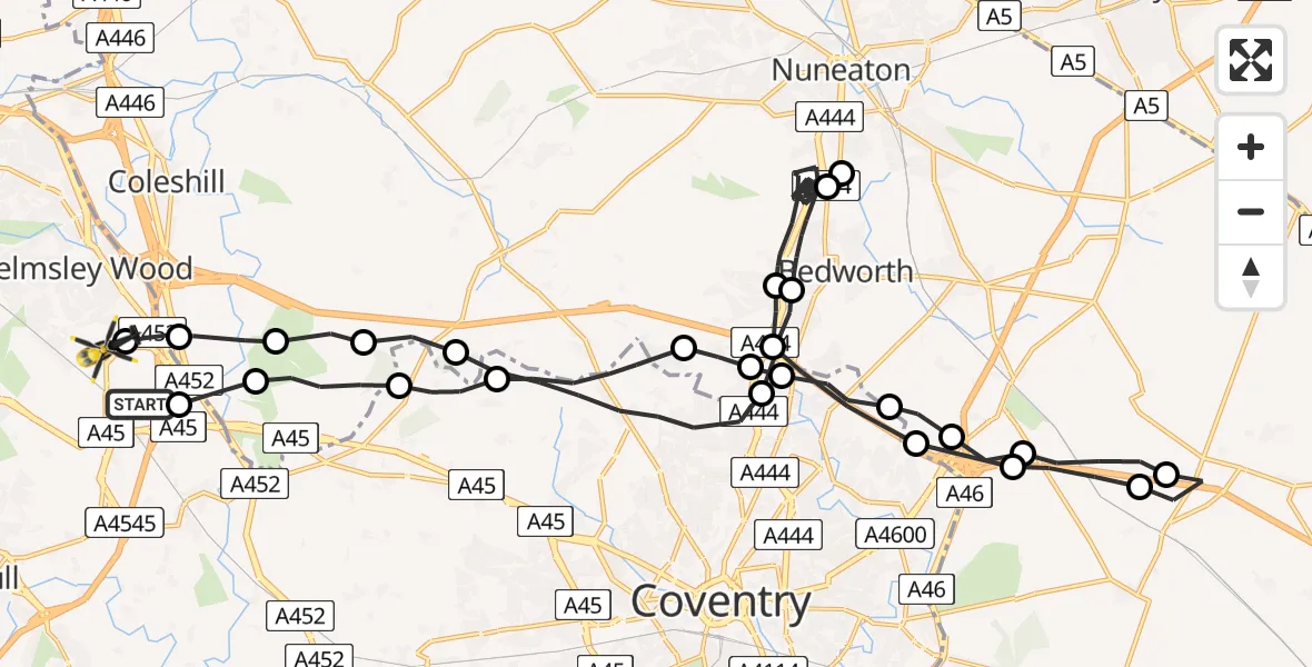
On Sunday, 25 January 2026 at 12:34, a Police Helicopter departed from Bickenhill to Coleshill Heath. It was the Police Helicopter with registration number G-POLJ. The flight lasted 24 minutes. During that period, the aircraft travelled 45 miles at an average speed of 112 miles per hour at a maximum altitude of 1700 feet.
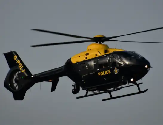
Helicopter: G-POLJ
The helicopter G-POLJ is used by the British police. The helicopter is deployed in pursuits, missing persons cases and other incidents where a helicopter provides added value.
Photo: Alec Wilson
46 miles
1700 feet
112 mph
25 minutes
12:34
12:59

Route
Blackfirs Lane, Solihull12:59
Coleshill Heath, Birmingham12:58
North Warwickshire, West Midlands12:58
North Warwickshire12:57
Maxstoke, North Warwickshire12:57
Fillongley CP, North Warwickshire12:56
Coventry, West Midlands12:54
Exhall, Coventry12:53
Bedworth, Nuneaton and Bedworth12:48
Nuneaton, Nuneaton and Bedworth12:48
Bedworth, Nuneaton and Bedworth12:45
Exhall, Nuneaton and Bedworth12:44
Coventry, West Midlands12:43
Ansty CP, Rugby12:43
Rugby12:42
Stretton under Fosse CP, Rugby12:41
Rugby12:40
Ansty CP, Rugby12:40
Rugby, West Midlands12:39
Coventry, West Midlands12:39
Nuneaton and Bedworth, West Midlands12:38
Ash Green, Coventry12:38
Coventry, West Midlands12:37
Meriden, Solihull12:36
North Warwickshire12:35
Solihull, West Midlands12:34
Pendigo Way, Birmingham12:34
Live flights
Today
Flights Bickenhill
Police Helicopter to Birmingham, Centro Way31 Mar 20:17
Police Helicopter to Bickenhill, Bird Island30 Mar 02:58
Police Helicopter to Birmingham, Centro Way28 Mar 11:03
Police Helicopter to Birmingham, Centro Way27 Mar 22:59
Police Helicopter to Bickenhill, A4526 Mar 00:23
Police Helicopter to Bickenhill, Centro Way25 Mar 17:09
Police Helicopter to Bickenhill23 Mar 04:29
Police Helicopter to Bickenhill23 Mar 04:29
Police Helicopter to Bickenhill23 Mar 04:29
Police Helicopter to Bickenhill23 Mar 04:29
Helicopter flights on your website?
You can easily display helicopter flights on your own website. Use the embed code.
