Air Ambulance Helicopter to Elstree Airfield, Elstree Airfield
Saturday, 24 January 2026 | 18:34 | From Luton
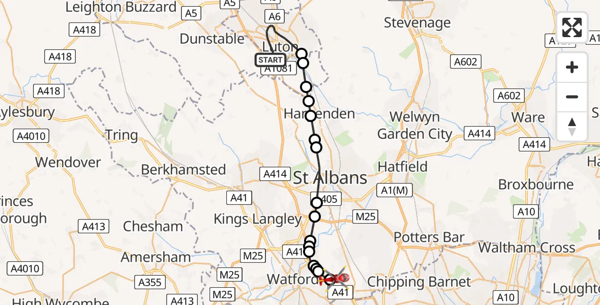
On Saturday, 24 January 2026 at 18:34, a Air Ambulance Helicopter departed from Luton to Elstree Airfield. It was the Air Ambulance Helicopter with registration number G-EHAT. The flight lasted 16 minutes. During that period, the aircraft travelled 21 miles at an average speed of 81 miles per hour at a maximum altitude of 1950 feet.
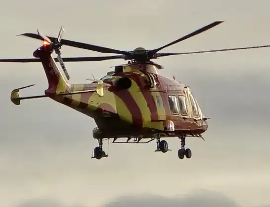
Helicopter: G-EHAT
The helicopter G-EHAT is used as a air ambulance helicopter. The main purpose of this aircraft is to transport a Mobile Medical Team to an incident as quickly as possible, enabling the trauma doctor to provide immediate first aid on site. The aircraft is flying this flight as Air Ambulance Helicopter.
Photo: By Steve Knight
22 miles
1950 feet
81 mph
16 minutes
18:34
18:49

Route
Elstree Airfield, Borehamwood, Hertfordshire18:49
Aldenham, Hertsmere18:49
Letchmore Heath, Hertsmere18:48
Bushey18:48
Bushey, Hertsmere18:48
Aldenham, Hertsmere18:47
Hertsmere18:46
St Albans18:46
Bricket Wood, St Albans18:45
Chiswell Green, St Albans18:45
St Albans18:43
Hatching Green, St Albans18:42
Hatching Green, Harpenden18:42
Harpenden, St Albans18:41
St Albans18:41
Hyde18:40
London Luton Airport, Luton, Bedfordshire18:40
Farley Hill, 18:34
Today
Police Helicopter to Epping Forest, Green Lane26 Feb 23:43
Flights Luton
Air Ambulance Helicopter to Luton, Farley Hill24 Jan 17:05
Air Ambulance Helicopter to Luton, Colley Lane14 Jan 09:28
Helicopter flights on your website?
You can easily display helicopter flights on your own website. Use the embed code.
