Police Helicopter to North Weald Bassett, Canes Lane
Saturday, 24 January 2026 | 18:04 | From Coopersale Street
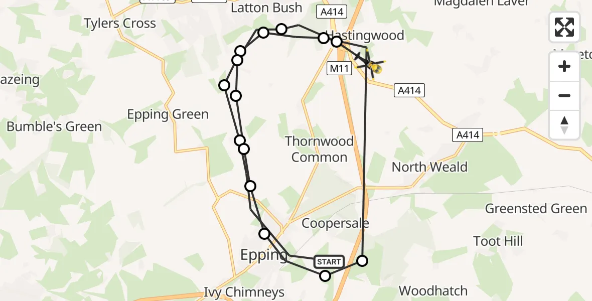
On Saturday, 24 January 2026 at 18:04, a Police Helicopter departed from Coopersale Street to North Weald Bassett. It was the Police Helicopter with registration number G-POLF. The flight lasted 12 minutes. During that period, the aircraft travelled 16 miles at an average speed of 80 miles per hour at a maximum altitude of 1700 feet.
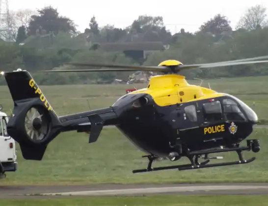
Helicopter: G-POLF
The helicopter G-POLF is used by the British police. The helicopter is deployed in pursuits, missing persons cases and other incidents where a helicopter provides added value.
Photo: James
16 miles
1700 feet
80 mph
12 minutes
18:04
18:16

Route
Canes Lane, Epping Forest18:16
North Weald Bassett, Epping Forest18:15
Latton Bush, Harlow18:15
North Weald Bassett, Epping Forest18:14
Epping Forest, Essex18:14
Thornwood Common, Epping Forest18:14
Coopersale Street, Epping18:14
Ivy Chimneys, Epping18:13
Coopersale Street, Epping18:13
Coopersale, Epping Forest18:13
North Weald Bassett, Epping Forest18:06
Latton Bush, Harlow18:06
North Weald Bassett, Epping Forest18:05
Latton Bush, Harlow18:05
Thornwood Common, Epping Forest18:05
Houblons Hill, Epping18:04
Today
Helicopter flights on your website?
You can easily display helicopter flights on your own website. Use the embed code.
