Air Ambulance Helicopter to Coventry Airport, Coventry Airport
Saturday, 24 January 2026 | 16:55 | From Hinton
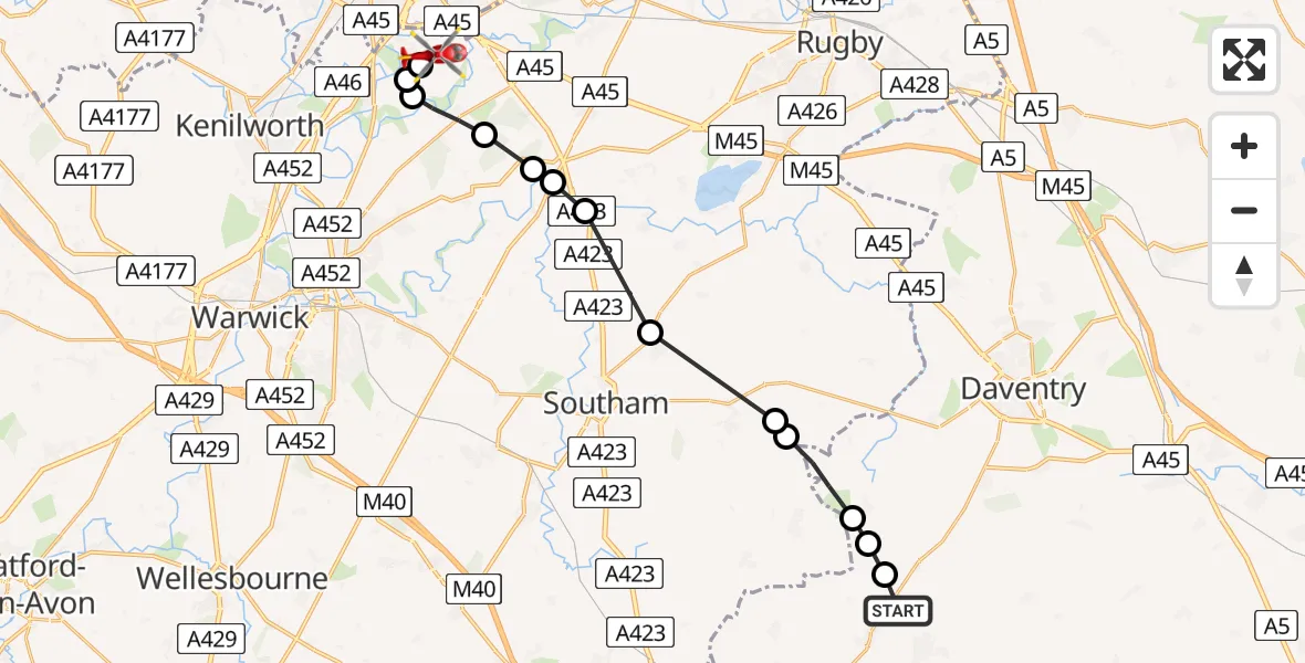
On Saturday, 24 January 2026 at 16:55, a Air Ambulance Helicopter departed from Hinton to Coventry Airport. It was the Air Ambulance Helicopter with registration number G-WNAS. The flight lasted 6 minutes. During that period, the aircraft travelled 18 miles at an average speed of 170 miles per hour at a maximum altitude of 2050 feet.
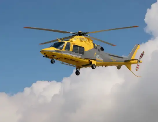
Helicopter: G-WNAS
The helicopter G-WNAS is used as an ambulance helicopter. The helicopter is equipped with a stretcher for transporting patients. The helicopter is often used to transport to hospitals.
Photo: Tony Melony
18 miles
2050 feet
170 mph
7 minutes
16:55
17:02

Route
Coventry Airport, Coventry, West Midlands17:02
Coventry Airport, Coventry, West Midlands17:01
Baginton, Warwick17:01
Stoneleigh, Warwick17:01
Bubbenhall, Warwick17:00
Princethorpe CP, Rugby17:00
Eathorpe, Warwick16:59
Marton CP, Rugby16:59
Stockton CP, Stratford-on-Avon16:58
Lower Shuckburgh, Stratford-on-Avon16:57
Priors Marston, Stratford-on-Avon16:57
Hellidon16:56
Catesby16:56
Byfield16:56
Charwelton Road, 16:55
Today
Police Helicopter to Epping Forest, Green Lane26 Feb 23:43
Flights Hinton
Helicopter flights on your website?
You can easily display helicopter flights on your own website. Use the embed code.
