Air Ambulance Helicopter to Byfield, Woodford Road
Saturday, 24 January 2026 | 16:20 | From Harborough
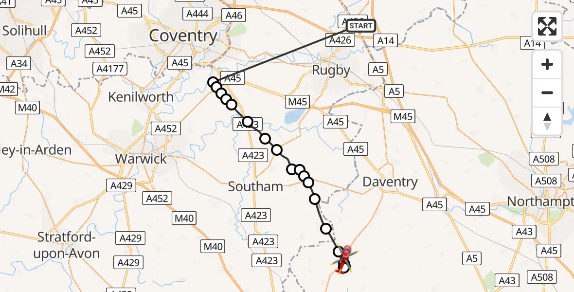
On Saturday, 24 January 2026 at 16:20, a Air Ambulance Helicopter departed from Harborough to Byfield. It was the Air Ambulance Helicopter with registration number G-WNAS. The flight lasted 10 minutes. During that period, the aircraft travelled 30 miles at an average speed of 179 miles per hour at a maximum altitude of 1950 feet.
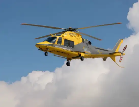
Helicopter: G-WNAS
The helicopter G-WNAS is used as an ambulance helicopter. The helicopter is equipped with a stretcher for transporting patients. The helicopter is often used to transport to hospitals.
Photo: Tony Melony
31 miles
1950 feet
179 mph
11 minutes
16:20
16:31

Route
Woodford Road, 16:31
Byfield16:30
Hinton16:30
Byfield16:29
Daventry16:28
Hinton16:28
Byfield16:28
Stratford-on-Avon16:27
Priors Marston, Stratford-on-Avon16:26
Lower Shuckburgh, Stratford-on-Avon16:25
Napton on the Hill, Stratford-on-Avon16:25
Grandborough CP, Rugby16:25
Tomlow Farm Airstrip16:24
Leamington Hastings CP, Rugby16:24
Birdingbury CP, Rugby16:23
Marton CP, Rugby16:22
Princethorpe CP, Rugby16:22
Stretton on Dunsmore CP, Rugby16:21
Rugby16:21
Bubbenhall, Warwick16:21
Rugby16:21
Gibbet Lane, 16:20
Live flights
Today
Police Helicopter to Epping Forest, Green Lane26 Feb 23:43
Flights Byfield
Flights Harborough
Police Helicopter to Harborough, Sulby Road19 Feb 16:07
Police Helicopter to Harborough, Sulby Road18 Feb 20:00
Police Helicopter to Harborough, Sulby Road18 Feb 14:05
Police Helicopter to Harborough, Sulby Road17 Feb 22:37
Police Helicopter to Harborough, Sulby Road17 Feb 18:36
Police Helicopter to Harborough, Sulby Road17 Feb 17:09
Police Helicopter to Harborough, Sulby Road17 Feb 13:57
Police Helicopter to Harborough, Sulby Road16 Feb 19:02
Police Helicopter to Harborough, Sulby Road15 Feb 15:08
Police Helicopter to Harborough, Sulby Road15 Feb 14:20
Helicopter flights on your website?
You can easily display helicopter flights on your own website. Use the embed code.
