Police Helicopter to MOD St Athan, MOD St Athan
Saturday, 24 January 2026 | 15:26 | From Brynsadler
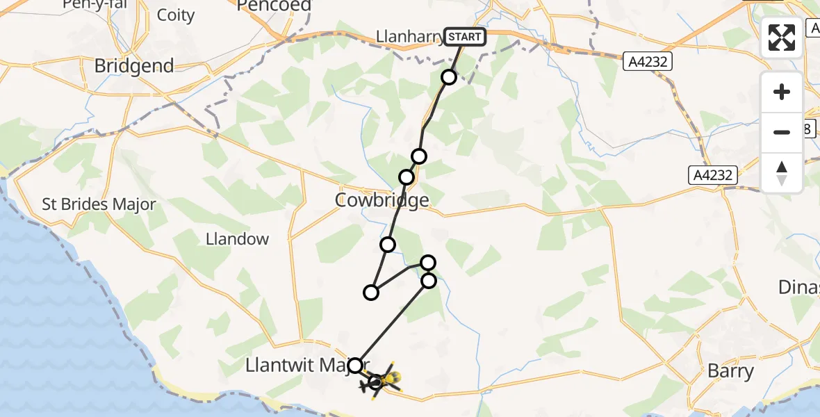
On Saturday, 24 January 2026 at 15:26, a Police Helicopter departed from Brynsadler to MOD St Athan. It was the Police Helicopter with registration number G-NWOI. The flight lasted 5 minutes. During that period, the aircraft travelled 11 miles at an average speed of 146 miles per hour at a maximum altitude of 1700 feet.
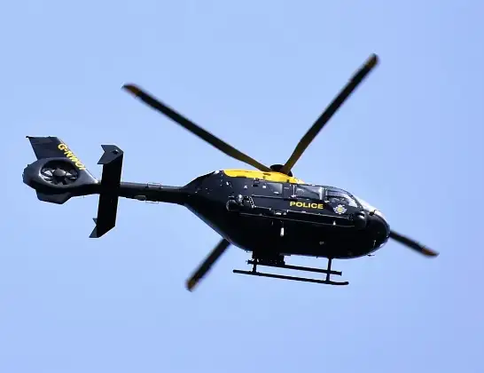
Helicopter: G-NWOI
The helicopter G-NWOI is used by the British police. The helicopter is deployed in pursuits, missing persons cases and other incidents where a helicopter provides added value.
Photo: Alec Wilson
12 miles
1700 feet
146 mph
5 minutes
15:26
15:31

Route
MOD St Athan, St Athan, Vale of Glamorgan15:31
MOD St Athan, St Athan, Vale of Glamorgan15:31
Boverton15:30
St Mary Church15:30
St Hilary15:30
St Mary Church15:29
Llandough15:29
Cowbridge15:28
Aberthin15:28
Ystradowen15:27
M4, 15:26
Live flights
Today
Police Helicopter to Epping Forest, Green Lane26 Feb 23:43
Flights Brynsadler
Police Helicopter to MOD St Athan, MOD St Athan24 Jan 15:26
Helicopter flights on your website?
You can easily display helicopter flights on your own website. Use the embed code.
