Air Ambulance Helicopter to Eye, Malster's Yard
Saturday, 24 January 2026 | 10:15 | From Norwich Airport
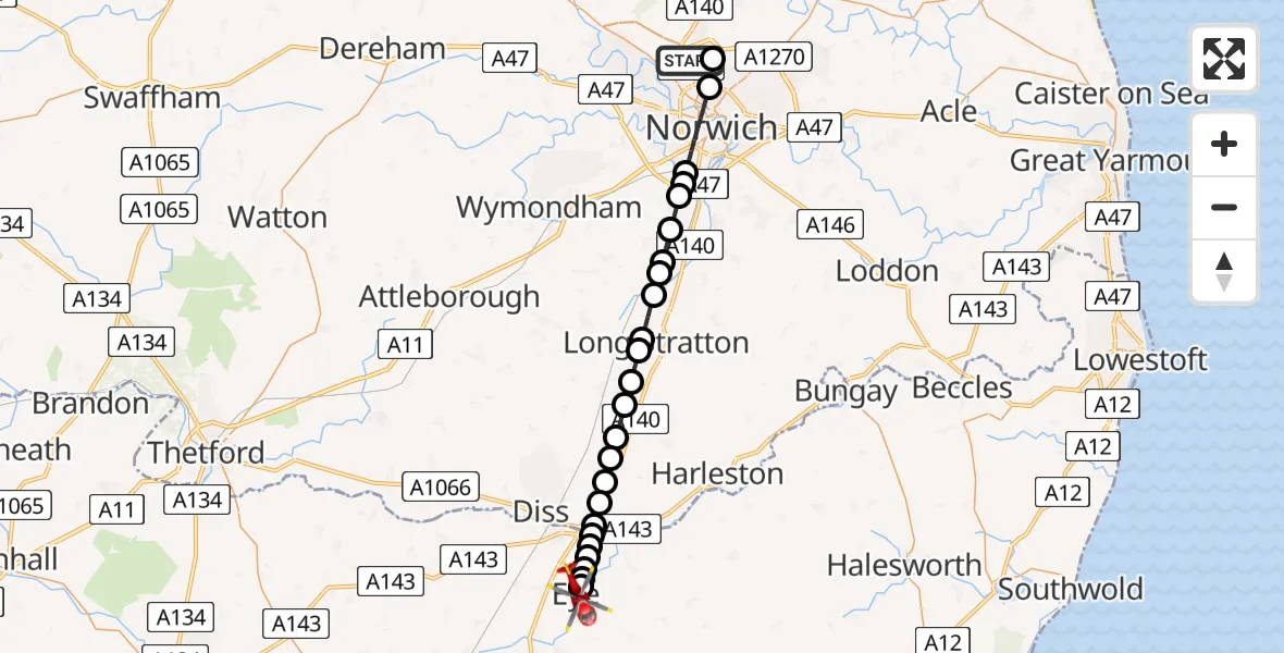
On Saturday, 24 January 2026 at 10:15, a Air Ambulance Helicopter departed from Norwich Airport to Eye. It was the Air Ambulance Helicopter with registration number G-HEMC. The flight lasted 18 minutes. During that period, the aircraft travelled 28 miles at an average speed of 95 miles per hour at a maximum altitude of 1675 feet.
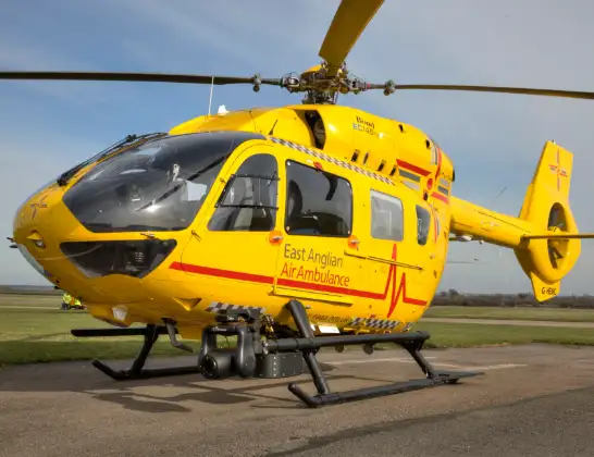
Helicopter: G-HEMC
The helicopter G-HEMC is used as a air ambulance helicopter. The main purpose of this aircraft is to transport a Mobile Medical Team to an incident as quickly as possible, enabling the trauma doctor to provide immediate first aid on site. The aircraft is flying this flight as Air Ambulance Helicopter.
Photo: Jsmauger
28 miles
1675 feet
95 mph
18 minutes
10:15
10:32

Route
Malster's Yard, Mid Suffolk10:32
Eye, Mid Suffolk10:30
Brome, Eye10:29
Mid Suffolk10:29
Brome, Mid Suffolk10:29
Oakley, Mid Suffolk10:29
South Norfolk10:28
Scole, South Norfolk10:28
Diss10:28
Dickleburgh, Diss10:27
Dickleburgh, South Norfolk10:27
Tivetshall St Mary, South Norfolk10:26
Tivetshall St Margaret, South Norfolk10:25
Great Moulton, South Norfolk10:25
Wacton, South Norfolk10:24
Long Stratton Airstrip, Long Stratton10:24
Tharston, South Norfolk10:23
Flordon, South Norfolk10:22
Newton Flotman, South Norfolk10:22
Mulbarton, South Norfolk10:21
Swardeston, South Norfolk10:21
Keswick, South Norfolk10:20
Keswick, Norwich10:20
Norwich10:18
Broadland10:17
Norwich Airport, Norwich, Norfolk10:17
Norwich Airport, Norwich, Norfolk10:15
Today
Police Helicopter to Epping Forest, Green Lane26 Feb 23:43
Flights Eye
Air Ambulance Helicopter to Ipswich, Heath Road24 Jan 11:12
Air Ambulance Helicopter to Eye, Malster's Yard24 Jan 10:15
Helicopter flights on your website?
You can easily display helicopter flights on your own website. Use the embed code.
