Police Helicopter to Boverton, Mill Lane
Friday, 23 January 2026 | 16:42 | From St Athan
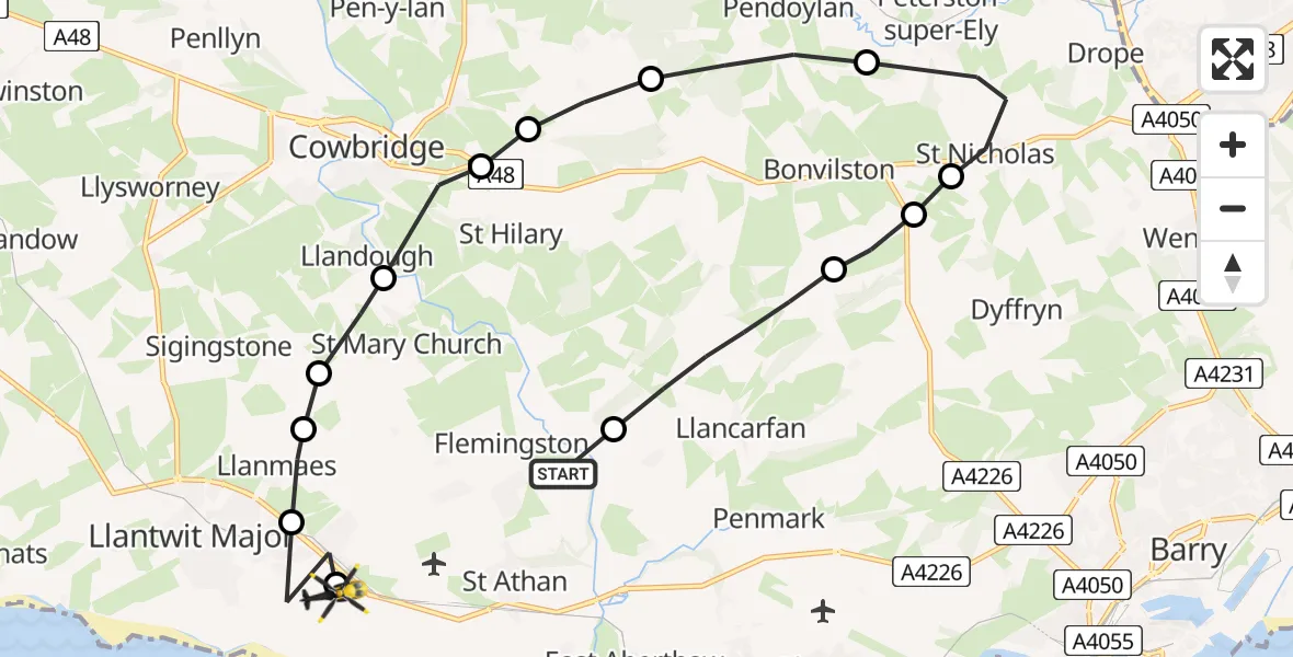
On Friday, 23 January 2026 at 16:42, a Police Helicopter departed from St Athan to Boverton. It was the Police Helicopter with registration number G-NWOI. The flight lasted 7 minutes. During that period, the aircraft travelled 17 miles at an average speed of 137 miles per hour at a maximum altitude of 2100 feet.
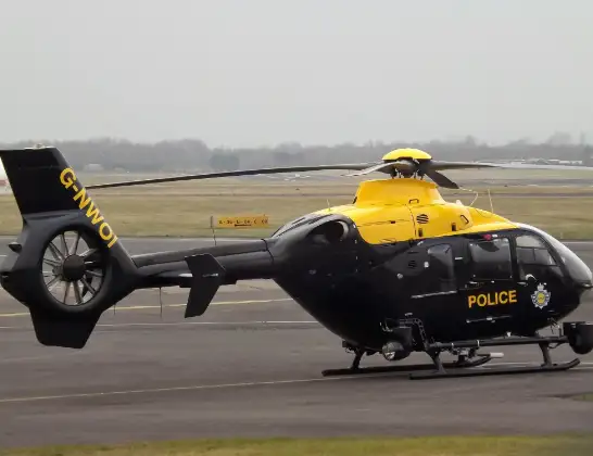
Helicopter: G-NWOI
The helicopter G-NWOI is used by the British police. The helicopter is deployed in pursuits, missing persons cases and other incidents where a helicopter provides added value.
Photo: James from Cheltenham
17 miles
2100 feet
137 mph
8 minutes
16:42
16:49

Route
Mill Lane, 16:49
MOD St Athan, St Athan, Vale of Glamorgan16:49
Boverton16:49
Llanmaes16:48
Sigingstone16:48
Llandough16:47
Cowbridge16:47
Aberthin16:47
Welsh St. Donats16:46
Pendoylan16:45
St Nicholas16:44
Bonvilston16:44
St Nicholas and Bonvilston16:44
Llancarfan16:42
St Athan, 16:42
Live flights
Today
Police Helicopter to Epping Forest, Green Lane26 Feb 23:43
Flights Boverton
Police Helicopter to MOD St Athan, MOD St Athan26 Feb 14:21
Police Helicopter to MOD St Athan, MOD St Athan20 Feb 18:11
Police Helicopter to MOD St Athan, MOD St Athan20 Feb 10:56
to Bryntirion, Heol yr Enfys15 Feb 15:51
Police Helicopter to MOD St Athan, MOD St Athan12 Feb 22:47
Police Helicopter to MOD St Athan, MOD St Athan12 Feb 18:27
Police Helicopter to Boverton, B42654 Feb 16:13
Police Helicopter to Boverton, Mill Lane30 Jan 11:01
Helicopter flights on your website?
You can easily display helicopter flights on your own website. Use the embed code.
