Coastguard Helicopter to Kirmington, Forty Foot Lane
Friday, 23 January 2026 | 15:37 | From Hornsea
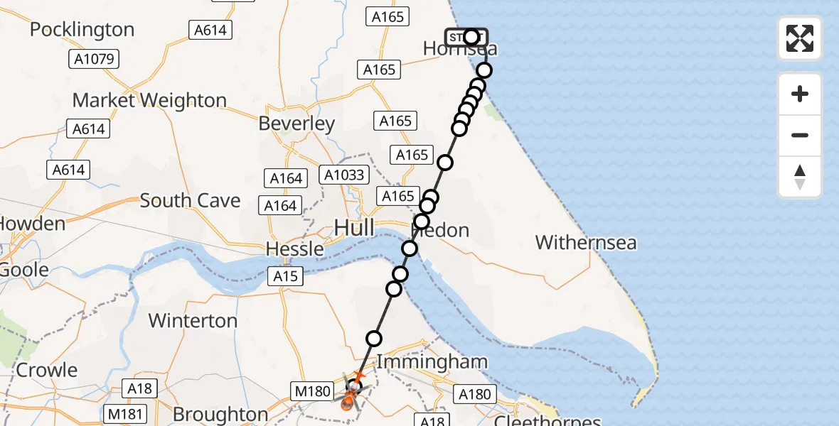
On Friday, 23 January 2026 at 15:37, a Coastguard Helicopter departed from Hornsea to Kirmington. It was the Coastguard Helicopter with registration number G-MCGE. The flight lasted 33 minutes. During that period, the aircraft travelled 26 miles at an average speed of 49 miles per hour at a maximum altitude of 2700 feet.
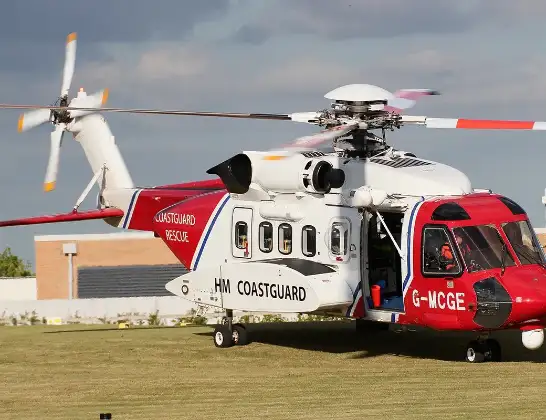
Helicopter: G-MCGE
The helicopter G-MCGE is used by the British Coastguard. The helicopter is deployed in search and rescue operations at sea, rescue operations involving ships or drilling platforms, patrols to prevent smuggling or piracy, environmental monitoring and disaster relief support.
Photo: Mike Burdett
27 miles
2700 feet
49 mph
33 minutes
15:37
16:10

Route
Forty Foot Lane, Greater Lincolnshire16:10
Kirmington, Greater Lincolnshire16:10
Ulceby, Greater Lincolnshire16:08
East Halton, Greater Lincolnshire16:06
Goxhill, Greater Lincolnshire16:06
North Sea16:05
Hedon, Hull and East Yorkshire16:04
Preston, Hull and East Yorkshire16:04
Wyton, Hull and East Yorkshire16:04
Sproatley, Hull and East Yorkshire16:03
West Newton, Hull and East Yorkshire16:02
Withernwick, Hull and East Yorkshire16:01
Hull, Hull and East Yorkshire16:01
Withernwick, Hull and East Yorkshire16:01
Mappleton, Hull and East Yorkshire16:01
Great Hatfield, Hull and East Yorkshire16:00
Rolston, Hull and East Yorkshire16:00
North Sea15:57
Hornsea, Hull and East Yorkshire15:56
North Sea15:37
Morrow Avenue, Hull and East Yorkshire15:37
Today
Police Helicopter to Epping Forest, Green Lane26 Feb 23:43
Flights Kirmington
Coastguard Helicopter to Cottingham, Green Lane27 Jan 14:25
Coastguard Helicopter to North Sea, North Sea23 Jan 16:28
Coastguard Helicopter to North Sea, North Sea22 Jan 08:59
Coastguard Helicopter to North Sea, North Sea21 Jan 10:35
Flights Hornsea
Helicopter flights on your website?
You can easily display helicopter flights on your own website. Use the embed code.
