Air Ambulance Helicopter to Woodhouse Eaves, Brook Lane
Friday, 23 January 2026 | 10:01 | From Willoughby on the Wolds
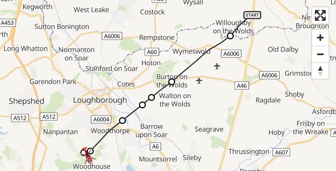
On Friday, 23 January 2026 at 10:01, a Air Ambulance Helicopter departed from Willoughby on the Wolds to Woodhouse Eaves. It was the Air Ambulance Helicopter with registration number G-DRLA. The flight lasted 5 minutes. During that period, the aircraft travelled 11 miles at an average speed of 138 miles per hour at a maximum altitude of 1850 feet.
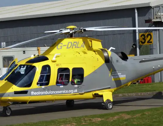
Helicopter: G-DRLA
The helicopter G-DRLA is used as an ambulance helicopter. The helicopter is equipped with a stretcher for transporting patients. The helicopter is often used to transport to hospitals.
Photo: Alec Wilson
12 miles
1850 feet
138 mph
5 minutes
10:01
10:06

Route
Brook Lane, Charnwood10:06
Woodhouse Eaves, Charnwood10:05
Woodhouse, Charnwood10:04
Woodthorpe, Charnwood10:04
Barrow upon Soar, Charnwood10:03
Walton on the Wolds, Charnwood10:03
Burton on the Wolds, Charnwood10:03
Wymeswold, Charnwood10:01
A46, Rushcliffe10:01
Live flights
Today
Police Helicopter to Epping Forest, Green Lane26 Feb 23:43
Helicopter flights on your website?
You can easily display helicopter flights on your own website. Use the embed code.
