Air Ambulance Helicopter to Caernarfon Airport
Thursday, 22 January 2026 | 12:47 | From Rhyl
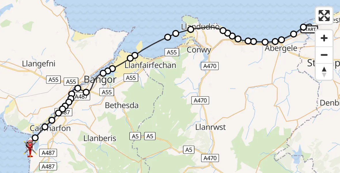
On Thursday, 22 January 2026 at 12:47, a Air Ambulance Helicopter departed from Rhyl to Caernarfon Airport. It was the Air Ambulance Helicopter with registration number G-LOYW. The flight lasted 20 minutes. During that period, the aircraft travelled 44 miles at an average speed of 130 miles per hour at a maximum altitude of 1950 feet.
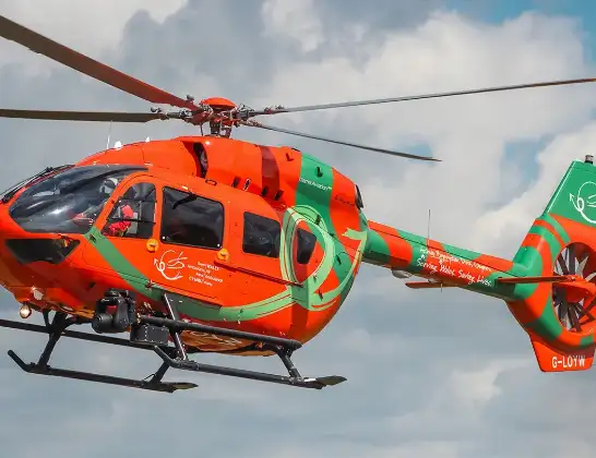
Helicopter: G-LOYW
The helicopter G-LOYW is used as a air ambulance helicopter. The main purpose of this aircraft is to transport a Mobile Medical Team to an incident as quickly as possible, enabling the trauma doctor to provide immediate first aid on site. The aircraft is flying this flight as Air Ambulance Helicopter.
Photo: Sarahpurpleface
44 miles
1950 feet
130 mph
21 minutes
12:47
13:07

Route
Caernarfon Airport, Caernarfon13:07
Caernarfon Airport, Caernarfon13:07
Caernarfon Airport, Caernarfon13:05
Llandwrog13:04
Bontnewydd13:03
Rhosyr13:03
Caernarfon13:02
Y Felinheli13:02
Llanddaniel Fab13:02
Llanfairpwllgwyngyll13:02
Y Felinheli13:01
Brynsiencyn13:01
Llanfairpwllgwyngyll13:01
Penrhos Garnedd13:00
Bangor12:59
Llandygai12:58
Llanfaes12:58
Aber12:57
Llanfairfechan12:57
Penmaenmawr12:55
Dwygyfylchi12:55
Llandudno12:54
Penrhyn-Side12:52
Colwyn Bay12:52
Mochdre12:52
Colwyn Bay12:52
Old Colwyn12:51
Llysfaen12:51
Llanddulas12:50
Abergele12:50
Pensarn12:50
Towyn12:49
Kinmel Bay12:48
Aquarium Street, 12:47
Live flights
Police Helicopter on its way from Dundrod12 Jul 22:50
Today
Police Helicopter to East Ardsley, Stoney Lane12 Jul 23:51
Police Helicopter to Birmingham Airport12 Jul 23:46
Police Helicopter to Parkham Ash12 Jul 23:41
Air Ambulance Helicopter to Newlands of Culloden12 Jul 23:24
Flights Rhyl
Air Ambulance Helicopter to Rhyl, Staircase5 Jul 15:34
Air Ambulance Helicopter to Rhyl, Rhuddlan Road27 Jun 15:28
Air Ambulance Helicopter to Rhyl, Rhuddlan Road25 Jun 14:35
Air Ambulance Helicopter to Rhyl, Rhuddlan Road21 Jun 22:41
Air Ambulance Helicopter to Rhyl, Rhuddlan Road27 Mar 18:43
Air Ambulance Helicopter to Caernarfon Airport26 Mar 10:13
Air Ambulance Helicopter to Rhyl, Rhuddlan Road21 Mar 12:29
Helicopter flights on your website?
You can easily display helicopter flights on your own website. Use the embed code.
