Air Ambulance Helicopter to Garve, Matheson Road
Thursday, 22 January 2026 | 9:49 | From Inverness Airport
On Thursday, 22 January 2026 at 9:49, a Air Ambulance Helicopter departed from Inverness Airport to Garve. It was the Air Ambulance Helicopter with registration number G-GSAS. The flight lasted 9 minutes. During that period, the aircraft travelled 24 miles at an average speed of 165 miles per hour at a maximum altitude of 2375 feet.
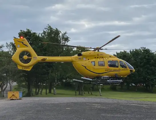
Helicopter: G-GSAS
The helicopter G-GSAS is used as a air ambulance helicopter. The main purpose of this aircraft is to transport a Mobile Medical Team to an incident as quickly as possible, enabling the trauma doctor to provide immediate first aid on site. The aircraft is flying this flight as Air Ambulance Helicopter.
Photo: Scanbus
25 miles
2375 feet
165 mph
9 minutes
09:49
09:58

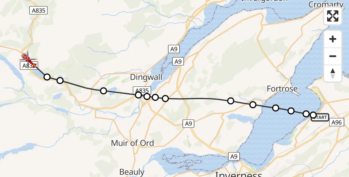
Route
Matheson Road, 09:58
Loch Garve09:57
Garve09:57
Strathpeffer09:56
Maryburgh09:55
Dingwall09:54
Conon Bridge09:54
Dingwall09:54
Inverness09:52
Munlochy09:51
Avoch09:51
Rosemarkie09:50
Inverness09:50
Ardersier09:49
Inverness Airport, Inverness09:49
Live flights
Today
Police Helicopter to Epping Forest, Green Lane26 Feb 23:43
Flights Garve
Coastguard Helicopter to Garve, Garve22 Feb 16:55
Coastguard Helicopter to Garve, Garve20 Feb 13:23
Air Ambulance Helicopter to Inverness, Inverness30 Jan 16:19
Air Ambulance Helicopter to Garve, Matheson Road24 Jan 22:04
Helicopter flights on your website?
You can easily display helicopter flights on your own website. Use the embed code.
