Air Ambulance Helicopter to Redcar, Green Lane
Wednesday, 21 January 2026 | 12:39 | From Sedgefield
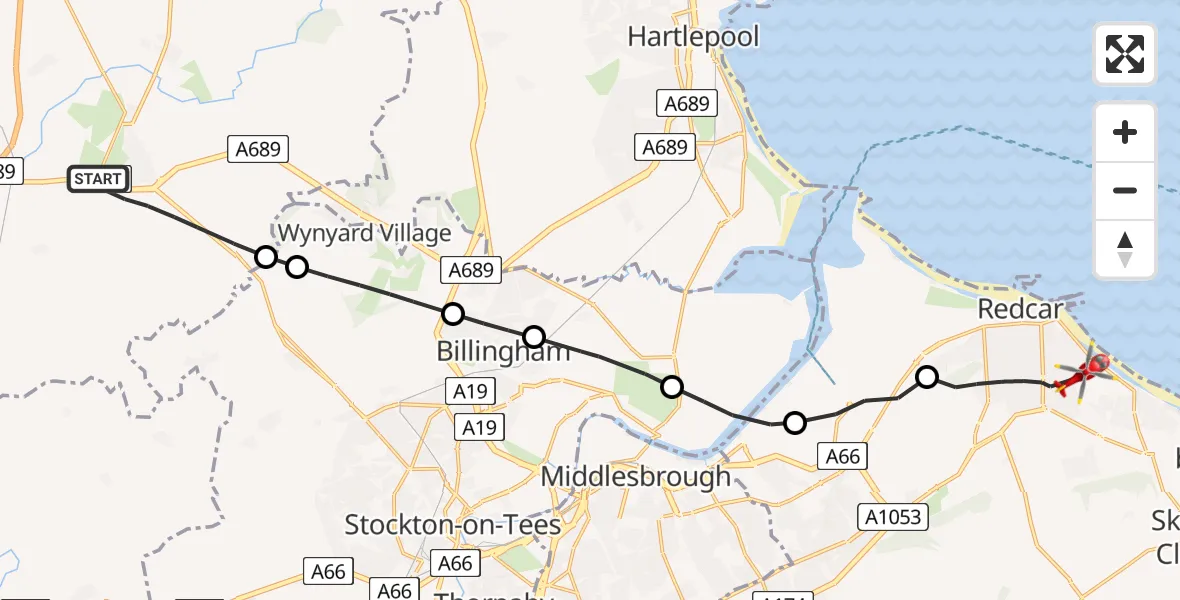
On Wednesday, 21 January 2026 at 12:39, a Air Ambulance Helicopter departed from Sedgefield to Redcar. It was the Air Ambulance Helicopter with registration number G-NHAE. The flight lasted 9 minutes. During that period, the aircraft travelled 18 miles at an average speed of 121 miles per hour at a maximum altitude of 2125 feet.
Helicopter: G-NHAE
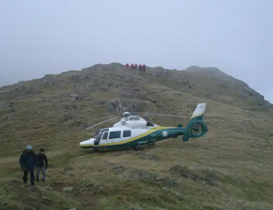
The helicopter G-NHAE is used as a air ambulance helicopter. The main purpose of this aircraft is to transport a Mobile Medical Team to an incident as quickly as possible, enabling the trauma doctor to provide immediate first aid on site. The aircraft is flying this flight as Air Ambulance Helicopter.
Photo: Michael Earnshaw
19 miles
2125 feet
121 mph
10 minutes
12:39
12:48

Route
Green Lane, Tees Valley12:48
Redcar, Tees Valley12:46
South Bank, Tees Valley12:45
Billingham, Tees Valley12:44
Cowpen Bewley, Billingham12:43
Billingham, Tees Valley12:43
Wynyard, Tees Valley12:41
Grindon and Thorpe Thewles, Tees Valley12:41
A689, North East12:39
Today
Police Helicopter to Epping Forest, Green Lane26 Feb 23:43
Flights Redcar
Air Ambulance Helicopter to James Cook University Hospital, James Cook University Hospital22 Feb 16:35
Air Ambulance Helicopter to Redcar, Greta Road24 Jan 08:29
Air Ambulance Helicopter to James Cook University Hospital, James Cook University Hospital21 Jan 13:40
Air Ambulance Helicopter to Redcar, Green Lane21 Jan 12:39
Air Ambulance Helicopter to James Cook University Hospital, James Cook University Hospital10 Jan 13:13
Air Ambulance Helicopter to Redcar, Green Lane10 Jan 12:16
Flights Sedgefield
Air Ambulance Helicopter to Redcar, Green Lane21 Jan 12:39
Air Ambulance Helicopter to Sedgefield, A17721 Jan 12:06
Helicopter flights on your website?
You can easily display helicopter flights on your own website. Use the embed code.
